A new study published in the journal Nature suggests that the global risks from rising seas may be greater than many coastal assessments indicate- not because the ocean is rising faster than expected, but because the baseline used in many studies may underestimate how high the sea already sits relative to coastal land.
The research, led by scientists Katharina Seeger and Philip Minderhoud, reviewed hundreds of scientific studies used to assess coastal flooding and sea-level rise impacts worldwide. It found that most of these assessments misalign sea-level measurements with land elevation data, potentially underestimating exposure to future flooding.
Sea-level rise is already one of the most widely studied consequences of climate change. According to the Intergovernmental Panel on Climate Change, global mean sea level could rise between 0.28 and 1.01 meters by 2100, depending on greenhouse gas emissions.
But the new study argues that how scientists measure the relationship between sea level and coastal elevation can significantly affect estimates of risk.
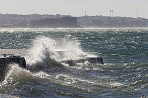
Severe storms and strong winds continue to batter Greece, prompting warnings for flooding and hazardous conditions across multiple regions. File photo
A methodological blind spot
The authors evaluated 385 peer-reviewed coastal hazard assessments and found that more than 90% of the studies either omitted sea-level information or applied it incorrectly when aligning sea-level data with elevation models used to calculate flood risk.
Many studies assumed that sea level corresponds to a theoretical reference surface known as a geoid- a gravity-based model approximating Earth’s mean sea level.
However, the real ocean surface often differs from this reference level due to ocean circulation, winds, temperature and salinity.
Because of this mismatch, the researchers found that measured coastal sea levels are on average about 0.3 meters higher than those assumed in many hazard assessments.
That difference can translate into large changes in estimates of vulnerability.
Using corrected measurements, the study estimates that with one meter of sea-level rise, between 31% and 37% more land and 48% to 68% more people, could fall below sea level compared with earlier assessments, increasing the number of exposed people to 77–132 million globally.
The authors warn that existing coastal adaptation strategies and risk models may need to be reassessed.
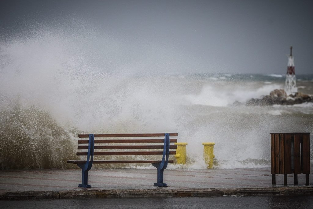
File Photo-
REUTERS/ Andrew Boyers
Why sea levels vary around the world
Sea-level rise is often discussed as a global average, but in reality it varies significantly from region to region, thus further complicating the estimated impact of sea level rise.
According to NASA, two major factors explain why sea levels do not rise evenly across the planet.
First, ocean circulation redistributes water through currents driven by winds, temperature differences, evaporation and rainfall. Climate cycles such as El Niño and La Niña can temporarily raise or lower sea levels in different regions.
Second, Earth’s gravitational field is uneven because mass is distributed unevenly across the planet. As ice sheets in Greenland and Antarctica lose mass, their gravitational pull weakens locally, causing seawater to redistribute toward regions farther away.
This means that some regions experience faster sea-level rise than others.
Satellite observations show that between 1993 and 2018, sea level rose by about 3 millimeters per year on average globally, although regional changes varied significantly.
The Nature study does not challenge these measurements. Instead, it highlights how errors in combining sea-level data with land elevation models can distort estimates of coastal exposure.
Implications for coastal planning
The researchers argue that improving the alignment between sea-level measurements and elevation data is essential for accurately assessing coastal vulnerability.
Without that correction, they warn, the scale and timing of future coastal flooding risks could be underestimated in many regions.
For policymakers, this could mean that adaptation measures — from coastal defenses to urban planning — may need to be implemented earlier than currently anticipated.