Greece bids farewell to the year in a distinctly wintry setting, as a fast-moving cold air outbreak brings a sharp drop in temperatures, strong northerly winds, and localized snowfall, even at relatively low elevations. The cold will peak today and tomorrow, before giving way to a rapid and noticeable rise in temperatures over the weekend.
Snowfall has already begun in Evia. At present, snow is falling in villages of the Dirfyon–Messapia municipality, from Steni toward Stropones, as well as in the Agios area and Setta in the municipality of Eretria. Regional snowplows are operating along the Steni–Stropones route to keep roads open.
The defining feature of this weather event is its short duration. According to meteorological analysis, conditions will improve quickly from west to east after midday, with most phenomena weakening rapidly. By the weekend, temperatures in some areas are expected to approach unusually mild levels for the season, nearing 20°C.
New Year’s Eve Weather
On New Year’s Eve, light rain is expected in parts of Central Greece, the Peloponnese, and the Aegean Sea, while Crete may see scattered morning thunderstorms. Northern regions will generally enjoy clearer conditions, though light morning snowfall is possible in Thrace.
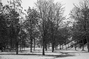
Temporary and light snowfalls are also forecast for mountainous and semi-mountainous areas of eastern and southern mainland Greece, as well as parts of Evia. In Attica (the wider Athens area), light rain or sleet is expected, with some snowfall limited to higher elevations such as Mount Parnitha, without significant disruption.
Temperatures:
- Northern and eastern mainland areas: around 7–9°C at midday
- Most other regions: 10–13°C
- Southern Aegean: up to 16°C
Temperatures will continue to fall sharply toward midnight.
Winds:
Northerly winds will be strong over the seas, reaching 6–7 on the Beaufort scale (strong to near-gale conditions) in the Aegean before gradually easing later in the day.
Major Cities:
- Athens (Attica): Around 9°C at midday, dropping sharply to about 2°C in the evening. Strong northerly winds in the morning, gradually weakening.
- Thessaloniki: Mostly sunny with some morning cloud. Temperatures from -1°C to 3°C, with strong northerly winds.
New Year’s Day and Friday
The new year will begin with biting cold. On New Year’s Day, there will be some cloud cover in eastern and southern regions, with light rain in the Cyclades and Crete, followed by rapid improvement. Sunshine will dominate most of the country.
Midday temperatures will remain low, reaching around 6°C in central and northern areas and 9–11°C elsewhere, with morning frost in several regions. Northerly winds will weaken, generally reaching up to 5 Beaufort, and up to 6 Beaufort in the Dodecanese.
On Friday, periods of cloudiness are expected in western and southern areas and the eastern Aegean. Rain will begin later in the day in the northern Ionian Sea and Epirus. Temperatures will rise slightly as winds turn southwesterly at moderate strength.
Weekend Weather Outlook
Saturday, January 3
Western Greece will see cloud cover with local rain and isolated thunderstorms. Elsewhere, increased cloudiness with local rain is expected, mainly in the eastern Aegean and Thrace, where isolated storms are possible. Temporary snowfall may occur in mountainous areas of western mainland Greece during the morning. Winds will be strong southerly to southwesterly, especially over the seas. Temperatures will rise further.
Sunday, January 4
Clouds will remain variable, at times denser, with local rain mainly in western and southern regions, the eastern Aegean, and Thrace. Southerly to southwesterly winds will persist at similar intensities, and temperatures will continue to climb.