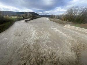
Greece enters Sunday, 23 November, with unsettled weather across several regions, even as temperatures remain relatively mild for the season. According to the Hellenic National Meteorological Service (EMY), rain, thunderstorms and even pockets of mountain snow will mark today’s conditions, along with a brief transfer of African dust toward the east.
Rain and Storms in the West, North and Eastern Aegean
The day starts with cloud cover building over the west, the north and the eastern Aegean, bringing local showers and thunderstorms—especially in the early hours. By late afternoon, most areas will see a clear improvement, with storms persisting mainly around the Rhodes–Kastellorizo region.
Mountain Snow in Epirus and Western Macedonia
Higher elevations in Epirus and western Macedonia will see temporary snowfall. Elsewhere, clouds will be thinner and more scattered, with a few brief showers before the weather steadies later in the day.
African Dust Moves Eastward
Weather patterns today also favor a short-lived transfer of African dust across eastern regions, reducing visibility at times and adding a slight haze to the atmosphere.
Temperatures Stay Mild
Despite the mixed conditions, temperatures remain relatively warm for late November:
- West & North: 18°C–20°C (12°C–14°C in the interior of Epirus and western Macedonia)
- Rest of Greece: 21°C–22°C
- Dodecanese: Up to 23°C–24°C
Winds will blow from the west at 4–6 Beaufort, shifting to northwesterlies by evening in several areas.
How the Weather Looks Today in Each Region
Attica
Mostly thin cloud cover, thicker in the morning, giving way to clear skies.
Winds: SW 4–5 Beaufort, turning NW later.
Temperature: 15°C–20°C.
Thessaloniki
Morning clouds, then brightening.
Winds: SW 4–5 Beaufort.
Temperature: 12°C–19°C.
Macedonia & Thrace
Showers early, storms in the east and some mountain snow in western Macedonia. Clearer from the afternoon.
Winds: SW 4–5 Beaufort, up to 6 in the east.
Temperature: 10°C–20°C (5°C lower in western Macedonia).
Ionian Islands, Epirus, Western Mainland, Western Peloponnese
Rain and local storms until midday, plus high-altitude snow in Epirus. Improving weather later.
Winds: SW 4–6 Beaufort, turning NW.
Temperature: 11°C–18°C (lower in interior Epirus).
Thessaly, Central Mainland, Evia, Eastern Peloponnese
Passing clouds with brief showers, clearing from early afternoon.
Winds: SW 4–6 Beaufort, turning NW.
Temperature: 10°C–21°C.
Cyclades & Crete
Thickening clouds and scattered light rain, mainly in Crete.
Winds: W 4–6 Beaufort.
Temperature: 15°C–22°C.
Eastern Aegean Islands & Dodecanese
Rain and thunderstorms—early in the east Aegean, later shifting to the Dodecanese—before easing in the north by afternoon.
Winds: S 4–6 Beaufort, turning W.
Temperature: 16°C–24°C.
Looking Ahead to Monday
Most of Greece will see milder conditions with patchy clouds and a few light showers in the Ionian and Crete. By late afternoon, new rain returns to the west, along with isolated thunderstorms over the northern Ionian at night.
Winds remain mostly NW at 3–5 Beaufort, shifting to SW up to 6 in the Ionian.
Temperatures will dip slightly, maxing at 15°C–16°C in the north and 17°C–19°C elsewhere, with 20°C–21°C in Crete and the Dodecanese.