Members of a risk assessment committee again convened on Wednesday ahead of a forecast cold front expected to pass through Greece on Thursday and Friday, with strong rains and storms affecting much of the mainland and Aegean islands.
The most intense phenomena are forecast for Friday.
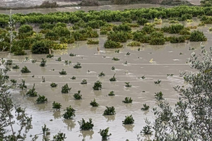
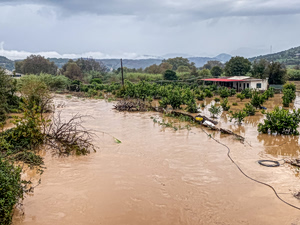
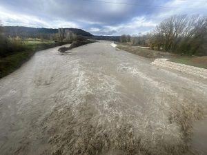
Although precipitation, especially longer-lasting and slower-melting snowfall, is a welcome development for a Greece facing the specter of water shortages in some areas and islands, sudden and intense rainfall and snowfall often generate dramatic problems for residents, i.e. flooding, landslides, blocked roadways, power outages.
A “red code” was declared for nine regions until Saturday, including the greater Athens-Piraeus area, meaning that civil protection authorities and first responders are on high alert.
⚠️ ⚠️⚠️ΕΚΤΑΚΤΟ ΔΕΛΤΙΟ ΕΠΙΚΙΝΔΥΝΩΝ ΚΑΙΡΙΚΩΝ ΦΑΙΝΟΜΕΝΩΝ
📌 Επισημαίνεται από την ΕΜΥ οτι τα φαινόμενα θα είναι κατά διαστήματα ιδιαιτέρως ισχυρά και δυνητικά επικίνδυνα (κόκκινη προειδοποίηση): στις περιφερειακές ενότητες Πιερίας – Ημαθίας – Χαλκιδικής – Θεσσαλονίκης, στη… pic.twitter.com/93pGAHeNy2— Theodoros Kolydas (@KolydasT) December 3, 2025
https://www.windy.com/airport/LIVE?40.074,22.447,6