
A period of weather instability currently affecting parts of Greece will soon give way to a powerful and persistent heatwave starting Monday, meteorologists have warned. While rain and thunderstorms are expected in various regions through the weekend, a sharp and prolonged rise in temperatures is forecast from July 21, with the mercury climbing well above 40°C in several areas.
Temperatures Drop Slightly Ahead of Upcoming Heatwave
Friday’s weather will be generally mild compared to what’s expected early next week. In northern mainland regions, temperatures will not exceed 32–34°C. Central and southern mainland Greece will see highs of 35–37°C, while the islands are expected to stay slightly cooler at 32–35°C.
Winds will blow from northern directions in the north and from the west in southern regions, ranging between 3 and 5 on the Beaufort scale.
Regional Weather Forecast for Friday
Macedonia and Thrace : Morning clouds are expected in Eastern Macedonia and Thrace, with possible local showers or isolated storms. Clouds will return in the afternoon across the region, especially in mountainous areas, where showers and scattered storms may occur. Winds will initially reach 6 Beaufort before dropping to 3–4. Temperatures will range from 19°C to 34°C.
Ionian Islands, Epirus, Western Central Greece, Western Peloponnese: Clear skies are expected, with afternoon clouds developing over the mainland. Local showers and isolated thunderstorms are likely in mountainous areas of Epirus and Western Central Greece. Winds will blow from the west-northwest at 3–5 Beaufort. Temperatures will range from 20°C to 36°C.
Thessaly, Eastern Central Greece, Evia, Eastern Peloponnese: Generally sunny, with afternoon cloud development over mainland areas. Isolated storms are possible, especially in the mountains of Thessaly. Winds will shift from northwest to variable at 3–4 Beaufort. Highs will reach up to 37°C, slightly cooler in Thessaly.
Cyclades and Crete: Clear skies are forecast throughout the day. Winds will come from the west at 3–5 Beaufort. Temperatures will range from 24°C to 33°C.
Eastern Aegean Islands and Dodecanese: Mostly sunny with mild winds — northerly in the north, westerly in the south — at 3–4 Beaufort. Temperatures will range from 24°C to 35°C, slightly cooler in northern parts.
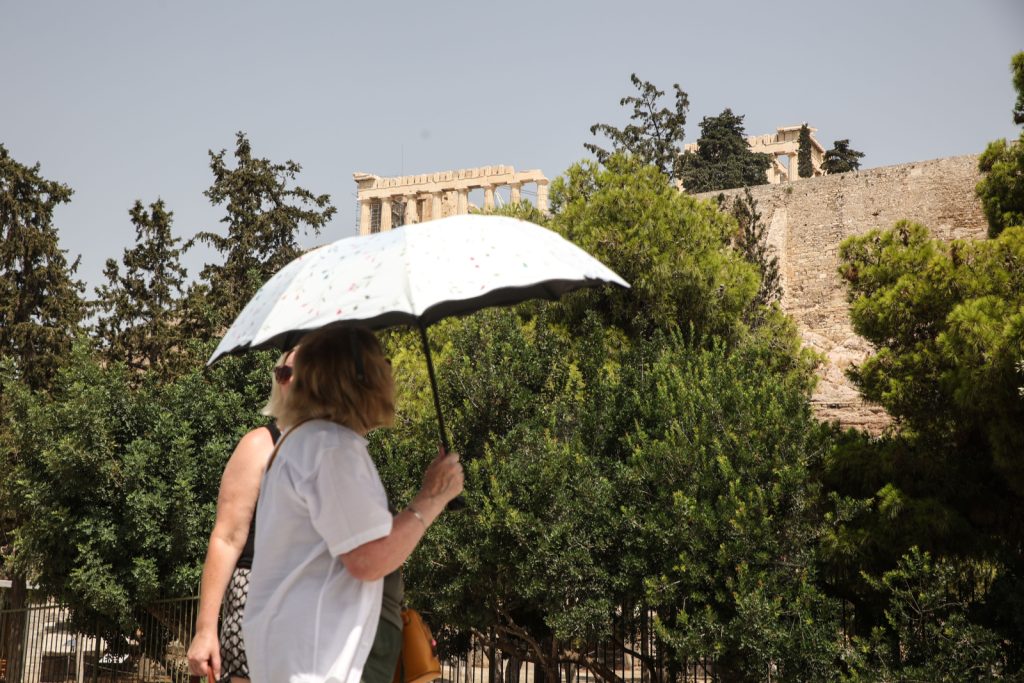
Athens: Clear skies with some afternoon cloudiness in northern suburbs. Winds will be light and variable at 3–4 Beaufort. Temperatures between 26°C and 36°C.
Thessaloniki: Partly cloudy skies, with clouds increasing in the afternoon and chances of showers or isolated storms. Winds will blow from the north-northwest at 5–6 Beaufort, easing to 4–5. Temperatures from 21°C to 33°C.
Intense Heatwave Expected from Monday
Although temperatures will remain at moderate levels through Sunday, a strong heatwave is expected to arrive in Greece on Monday.
According to forecasts from meteorologist Giannis Kallianos, temperatures could reach up to 44°C during the coming week, making this the most significant heatwave of the summer so far, though not unprecedented in its severity.
“This upcoming heatwave will clearly be the strongest of the summer to date,” Kallianos noted, emphasizing its dual intensity and duration. The heat is expected to last at least until Friday, July 25, potentially even longer.
Meteorological models (such as ECMWF, GFS, ICON, and others) indicate the highest temperatures will occur between July 22 and July 24. However, due to medium-range forecasting uncertainty, these projections could be updated as new observational data become available.
Another meteorologist, Georgios Tsatrafyllis, suggested that the heatwave may last longer than initially forecast. “The high temperatures will begin Sunday, July 20, with a significant peak expected on Tuesday, July 22—the hottest day of the summer so far,” he said. The oppressive conditions could persist until Saturday, July 26.
Widespread Discomfort Expected
With temperatures soaring across the mainland and islands, the atmospheric conditions are expected to become particularly stifling in urban centers like Athens. Residents and tourists alike are seeking shade and cool relief in any form—from handheld fans to cold drinks.
Specialist weather researcher Theodoros Giannaros from the National Observatory of Athens warned that temperatures could exceed 43°C, particularly in regions like Thessaly and Laconia. The impact will be especially difficult for outdoor workers and those relying on public transportation systems, where air conditioning is often limited or malfunctioning.
Weekly Weather Overview
Friday, July 18: Mostly clear, but local clouds and isolated storms expected in eastern Macedonia, Thrace, and some central and northern highland areas. Temperatures between 32°C and 38°C.
Saturday, July 19: Sunny with localized clouds and potential showers in central Macedonia and Thessaly. No significant change in temperatures.
Sunday, July 20: General sunshine with afternoon clouds and isolated showers in inland mountainous regions. Temperatures nearing 39°C in mainland areas.
Monday, July 21: Clear with a slight temperature rise. Winds strengthen in the Aegean.
Tuesday, July 22: Peak heatwave conditions. Temperatures will be at their highest levels for the week, with forecasts of up to 44°C in parts of Thessaly, eastern Central Greece, and the eastern Peloponnese.
This summer’s most intense heatwave is poised to test endurance across the country. With temperatures threatening to reach 45°C in some areas, Greece is preparing for a sweltering week ahead
Greece will see a temporary dip in temperatures on Friday, offering short-lived relief before a significant heatwave is expected to grip the country starting Monday. Forecasts indicate mostly clear skies in many regions, with occasional cloud cover and isolated storms, particularly in mountainous areas of the mainland.