
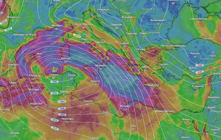
Greece is facing a significant deterioration in weather conditions as a strong and potentially dangerous low-pressure system develops over the central Mediterranean and moves east toward the country. According to meteorologist Georgios Tsatrafyllias, the system is expected to impact large parts of Greece from Tuesday, with conditions becoming increasingly severe through Thursday.
The weather pattern is forming near Tunisia and is forecast to organize rapidly as it travels toward southeastern Europe. While the recent intense cold is expected to gradually ease, it will be replaced by extreme weather phenomena, including violent winds, heavy rainfall, thunderstorms, and snowfall in mountainous regions.
Strong Winds and Storms from Tuesday to Wednesday
During Tuesday and Wednesday, the dominant feature will be gale-force winds, mainly from eastern and southeastern directions. In western and southern parts of the country, as well as across central regions and parts of the Aegean Sea, wind intensity may reach 9 to 10 on the Beaufort scale. Gusts could locally reach speeds of up to 120 kilometers per hour, posing risks to transport, coastal areas, and infrastructure.
Flood Risk Peaks from Wednesday to Thursday
From Wednesday into Thursday, conditions are expected to become even more hazardous. The low-pressure system is forecast to trigger powerful thunderstorms and very heavy rainfall, raising the risk of flooding. Areas identified as particularly vulnerable include western and southern Greece, the eastern Aegean islands, the greater Athens region, nearby islands, and Crete. Authorities are urging heightened caution, especially in urban areas prone to water accumulation.
Snowfall in Mountain and Semi-Mountain Regions
At the same time, dense snowfall is expected in mountainous and semi-mountainous areas of central and northern Greece. There is also a risk of snowstorms and thundersnow, which could disrupt road travel and affect remote communities.
Forecast to Become Clearer Within 24 Hours
Tsatrafyllias notes that the forecast will become more precise within the next 24 hours, as meteorologists gain a clearer picture of the system’s final development and trajectory. Until then, residents—particularly in high-risk regions—are advised to closely follow official weather updates and take precautionary measures ahead of the severe conditions.