
Greece is set to experience its first snowfall of the season later this month, while much of Europe braces for severe winter weather, according to meteorologist Klearchos Marousakis.
Marousakis forecasts a significant cold snap across large parts of Europe, with heavy snow expected to reach even major cities. In contrast, the eastern Mediterranean, including Greece, has so far enjoyed milder autumn conditions. However, this period of warmer weather is coming to an end. The first winter “spikes” are anticipated in the third ten-day period of November, with snow initially affecting mountain areas before possibly descending to lower altitudes.
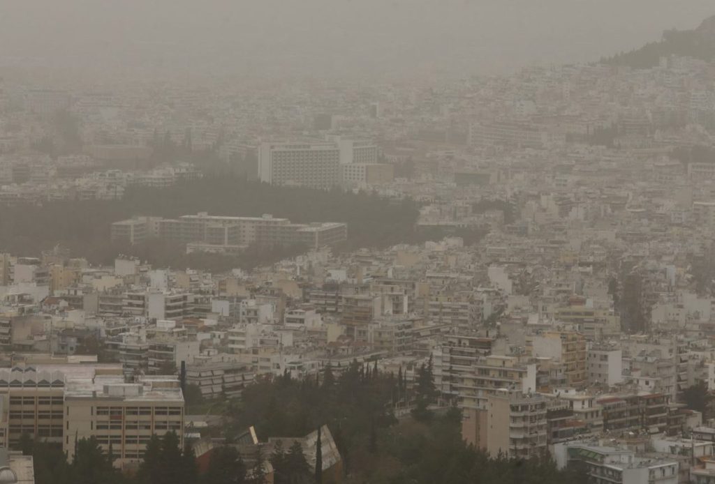
Meanwhile, Greece is experiencing unsettled weather with rain, thunderstorms, and the influence of African dust reducing air quality and visibility in several regions.
Today, strong rainfall and isolated thunderstorms are expected in western and northern Greece, particularly in the Ionian Islands, Epirus, and parts of western Sterea and Thrace. Southern winds will carry dust from Africa, creating hazy conditions in affected areas.
Temperature forecasts show mild conditions for this time of year: northern regions may reach up to 21°C, western areas 23°C, and eastern inland areas and Crete up to 24–25°C. Athens is expected to see partly cloudy skies with temperatures between 17–22°C, while Thessaloniki may experience light rain and highs of 20°C.
The Hellenic National Meteorological Service (EMY) has issued an alert for locally heavy rain and storms through Wednesday, particularly in the northern Ionian Islands, Epirus, and western Aetolia-Acarnania. The combination of rain and African dust will continue to affect air quality across the country.
Looking ahead, Thursday and Friday will see continued localized rain in western, northern, and eastern Aegean regions, with sporadic thunderstorms in western Sterea, the Peloponnese, and northern Ionian Islands. Temperatures will remain largely stable, with only minor variations across regions.