Greece is set for a dramatic weather shift this weekend, with forecasters warning of both dangerous storms and intense heat.
According to meteorologist Klearchos Marousakis, a low-pressure system moving in from Italy is expected to bring severe rainfall and thunderstorms from Saturday afternoon. The unsettled weather will first hit the northwest before spreading on Sunday to large parts of western, central, and northern Greece.
Authorities caution that the storms could be particularly strong in western and northern regions, possibly accompanied by hail and frequent lightning strikes.
Heatwave in the east and south
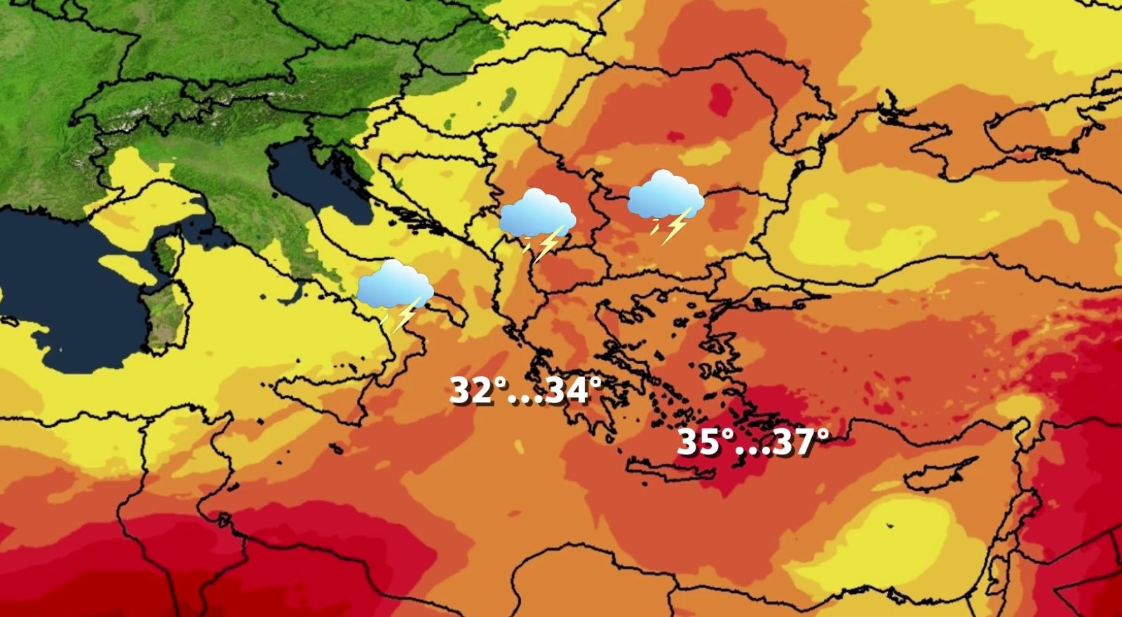
While some areas brace for storms, others will face soaring heat. Shifting winds from the southwest are forecast to carry hot air masses from North Africa, pushing temperatures to 35–37°C. The rise will be most noticeable in eastern mainland Greece, where dry winds are expected to intensify the heat.
Official forecast for the weekend
The Hellenic National Meteorological Service (EMY) predicts a mixed picture for the last weekend of August.
- Saturday (30 August): Mostly clear skies in the morning. From midday, clouds and thunderstorms are likely over the Ionian Sea and Epirus. Winds will blow mainly from the southwest at 3–5 Beaufort, while temperatures remain stable.
- Sunday (31 August): Storms and rain are forecast in the west and north, easing gradually through the day. The rest of the country will see fair weather with some clouds. Winds will strengthen in parts of the Aegean, while temperatures will dip slightly in western and northern regions.
Forecasters are urging residents and travelers to remain cautious, as conditions may change rapidly, bringing both hazardous storms and uncomfortable heat within the same 48-hour period.