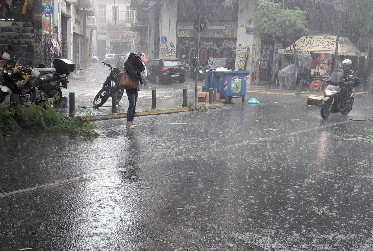
A powerful weather system named Adel is striking large parts of Greece, with Athens experiencing relentless rainfall, thunderstorms and extensive lightning from early Friday morning. Several streets in the capital have already flooded, creating hazardous conditions for drivers and pedestrians. Authorities are urging residents to stay cautious and follow safety instructions as the storm intensifies.
Meteorologists warn that the risk of large hail is high, including in the wider region of Attica. Friday’s rainfall has been classified as a category 4 event, indicating “very significant” severity.
Across northern Greece, strong storms are already affecting areas such as Eastern Macedonia and Thrace. Later in the day, the weather system is expected to reach the regional units of Halkidiki, Serres, Kilkis and Thessaloniki. In the Ionian Islands and parts of the Peloponnese, heavy rain will continue through the morning, while the Eastern Aegean and the Dodecanese will face the peak of the storm from midday into the night.
Meteorologist Theodoros Kolydas warns of a “double wave” of severe weather in Attica, with one round of storms overnight and a second after daybreak Friday. Eastern Macedonia and Thrace are also expected to see worsening conditions throughout the afternoon, with particular concern for the islands of Chios, Samos and Ikaria. By late Friday night, the most intense weather is forecast to shift toward the Dodecanese, where the storm will remain strong until midday Saturday before gradually weakening.
Red Alert in Four Regions
Greece’s Ministry of Climate Crisis and Civil Protection has issued a “red code” alert—its highest level—for Eastern Macedonia, Thrace, the Northern Aegean and the Dodecanese. Additional regions remain on heightened standby, including the Ionian Islands, Epirus, Western Greece, the Peloponnese and Central Macedonia.
Emergency coordination centers are in continuous contact with local authorities, with all regional civil protection councils convened to ensure rapid response if conditions worsen.
National Weather Service Forecast
According to Greece’s National Meteorological Service, heavy rain and thunderstorms are expected:
- In Eastern Macedonia and Thrace, and in the regional units of Halkidiki, Serres, Kilkis and Thessaloniki through the afternoon
- In the Ionian Islands and the western and southern Peloponnese throughout the morning
- In the Eastern Aegean from midday
- In the Dodecanese from the evening onward
Snow is also expected in mountainous areas of Epirus, Western Macedonia, Thessaly and Western Central Greece.
Strong southerly winds will affect much of the country, reaching up to 7 on the Beaufort scale in parts of the Aegean. Temperatures will drop slightly, with highs ranging from 16–18°C in the west and north, and up to 23°C in southeastern island regions.
Outlook for the Weekend
On Saturday, unsettled weather will continue across most of Greece, including thunderstorms in the Ionian Islands, Eastern Macedonia, Thrace, the Cyclades, Crete, the Eastern Aegean and the Dodecanese. The strongest conditions in the eastern island regions are expected to ease from midday.
Sunday is forecast to bring milder conditions with only scattered showers, while Monday will see increasing cloud cover, light rainfall in western areas and a slight rise in temperatures.