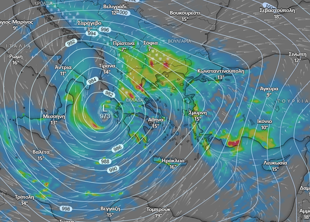

Much of mainland Greece and the islands may face a significant early Spring low front next Tuesday and Wednesday, with forecasts citing a 25% chance of a so-called “weather bomb,” based on the latest meteorological model data.
In the short term, scattered showers are expected across parts of the country over the weekend, although no major or widespread disruption is anticipated. Conditions are set to improve on Monday, with a temporary easing of inclement weather.
A day later, however, strong low-pressure system arriving from the central Mediterranean is projected to move through Greece. If the low front rapidly intensifies, then severe weather phenomena are possible, such as heavy rainfall and thunderstorms, gusty winds, flash flooding and snowfall in mountainous regions. The most intense phenomena, if confirmed, are expected to peak on Wednesday.
Updated data over the weekend will provide for a clear forecast.