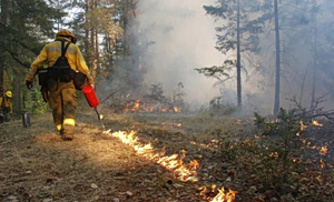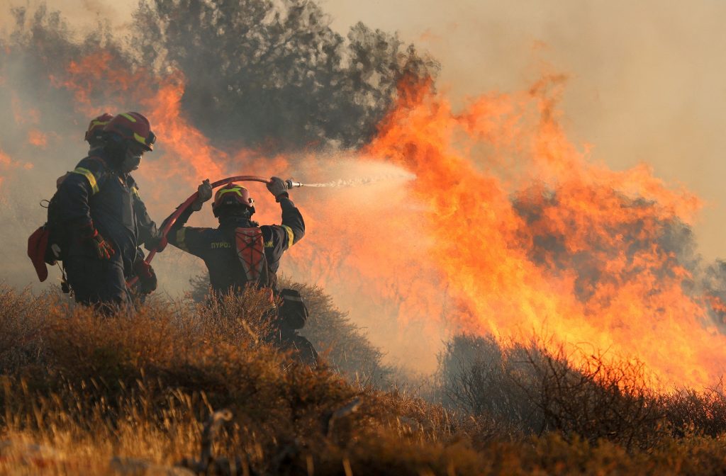
Europe’s wildfire crisis deepened in 2025, with the EU recording historic wildfire losses as fires swept across an unprecedented geographic range. From the Iberian Peninsula to Eastern Europe, and into parts of North Africa and the Middle East, the scale of destruction spans an entire region and reflects a fire regime that is no longer confined to traditional hotspots.
According to the European Commission’s Joint Research Centre, a total of 2,242,195 hectares were burned in 2025 across the European Forest Fire Information System (EFFIS) area, which includes Europe, the Middle East and North Africa. This represents a 20% increase compared to 2024 and almost two and a half times the area burned in 2023. Fires were detected in 46 countries, with Ukraine alone accounting for nearly 30% of the total burnt area, underscoring how the burden of extreme fire seasons is now distributed across a wider and more complex landscape.
The regional breakdown highlights this shift. Of the total area burned, 1,079,538 hectares were within the EU27, while 1,092,095 hectares were recorded in other European countries, and a further 70,562 hectares in the Middle East and North Africa. The near-equal split between EU and non-EU Europe reflects a continent-wide escalation in wildfire risk rather than a crisis limited to southern member states.
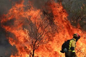
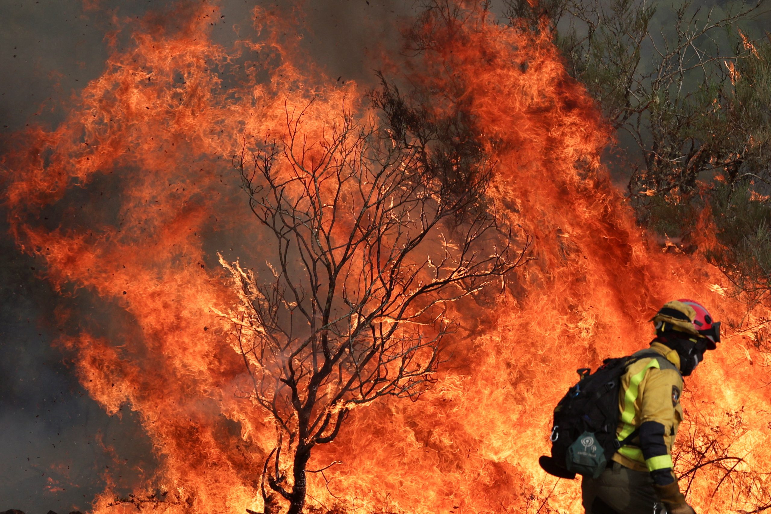
Within the European Union, 2025 was a record-setting year. Fires were mapped in 25 of the 27 member states, with only Luxembourg and Malta unaffected. The total burnt area — 1,079,538 hectares — is the highest ever recorded by EFFIS in the EU and nearly double the long-term average. The peak came during July and August, when some of the largest fires of the year were recorded, particularly in Spain and Portugal.
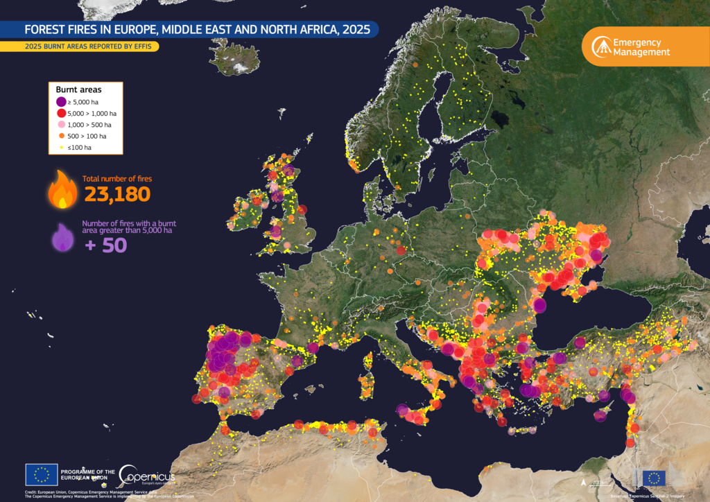
Map of 2025 Wildfires. Credit: Copernicus Emergency Management Service (CEMS)
Southern Europe bore the brunt of the damage. Spain recorded 401,266 hectares burned, followed by Portugal with 284,012 hectares, Romania with 134,370 hectares, and Italy with 96,539 hectares. Beyond the EU, Türkiye saw 162,188 hectares burned, while the United Kingdom recorded 54,050 hectares. Ukraine stood apart, with 659,853 hectares burned and more than 9,000 fires mapped- by far the largest national total in the report.
The environmental impact was particularly severe in protected areas. A total of 424,023 hectares burned within Natura 2000 sites across the EU27, which is the highest figure ever recorded, accounting for around 39% of all burnt area in the EU. Spain, Romania and Portugal together represented nearly three quarters of the damage in these protected zones, highlighting the vulnerability of Europe’s most important ecosystems to increasingly extreme fire seasons.
Beyond forests, the fires cut across a range of landscapes. The report shows that, excluding Ukraine to avoid statistical distortion, 41% of burnt area occurred in other natural land such as scrub and grassland, 19% in agricultural land, and 25% in forests. This distribution reflects a broader transformation in fire dynamics, where agricultural and transitional landscapes are increasingly part of large-scale fire events.
For Greece, the 2025 fire season was relatively stable compared to recent years, though still slightly above long-term averages. With a total burnt area of 48,998 hectares, the season was in line with 2024, according to the report. Fire activity was concentrated between June and August, with a number of smaller fires also recorded in September and October. In total, 235 fires were mapped across the country, although only 18 exceeded 500 hectares, which highlights how a relatively small number of large fires continue to account for a significant share of the overall damage. The largest fire occurred on the island of Chios, where nearly 8,000 hectares burned.
Importantly, the impact extended into protected areas. Around a quarter of the total burnt area (12,099 hectares) burned within Natura 2000 sites in Greece. This underscores a persistent vulnerability: even in years that are not among the most extreme, fires continue to affect environmentally sensitive regions.
The land cover data for Greece further illustrate the nature of the damage. Agriculture accounted for the largest share of burnt area at 14,341 hectares, followed by other natural land at 12,714 hectares and sclerophyllous vegetation at 11,910 hectares. Forest losses were comparatively smaller, with coniferous, broadleaf and mixed forests together representing a limited share of the total.