Greece will experience a significant weather change on Friday with widespread unsettled conditions, strong to near-gale winds, and rising temperatures, particularly in the north. Morning frost is expected in northern mainland areas, while visibility may be reduced locally during early and late hours.
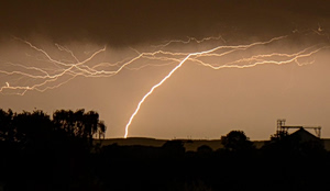
Early in the day, clouds will cover most of the country, densest in western regions where rain and thunderstorms will affect Epirus, the Ionian Sea, western Greece, and western Peloponnese. Some storms will produce hail and locally gusty winds. Rain will gradually move eastward, reaching Central Greece by midday. Thunderstorms will also impact Aegean islands, Macedonia, and Thrace. Snowfall is expected over the Pindus mountains above 1,200 meters.
Temperatures
- Northern Greece: -2 to 17°C (Western Macedonia: -3 to 12°C)
- Central & Southern Greece: 1 to 16°C
- Western Greece: 3 to 18°C (Epirus: 0 to 11°C)
- Cyclades: 5 to 17°C
- Crete: 5 to 22°C
- Eastern Aegean islands: 3 to 18°C
- Dodecanese: 8 to 16°C
Winds
- Aegean Sea: Southerly, strong to very strong at 6–7 Beaufort.
- Ionian Sea: Westerly 4–5 Beaufort, southern Ionian strong at 6 Beaufort, turning westerly in the afternoon.
Athens (Attica Region)
Morning clouds with locally reduced visibility, followed by heavy rain and isolated thunderstorms after midday, easing in the evening. Temperatures from 7 to 16°C, 2–3°C cooler in northern suburbs. Southerly winds strong at 6 Beaufort, gradually easing later.
Thessaloniki
Mostly cloudy with moderate to strong southerly winds at 5–6 Beaufort. Temperatures from 4 to 15°C.