Greece is set for a sharp change in weather from Friday, June 12, as increased atmospheric instability is expected to bring rain, thunderstorms and a drop in temperatures across several areas of the country.
The strongest weather phenomena are forecast mainly in northern and central Greece, with storms potentially accompanied by frequent lightning, local hailstorms and temporary strong winds. Temperatures will also fall, especially in western, central and northern regions, while northern winds are expected to strengthen locally.
The unsettled conditions are expected to continue into Saturday before gradually easing, with weather improving in most areas on Sunday.
Heavy storms expected on Friday
From Friday morning, clouds and local showers will develop in Macedonia, with scattered thunderstorms gradually spreading to other mainland areas and the northern Aegean.
The most intense phenomena are expected in Macedonia from late morning, followed by parts of Epirus and Thessaly from midday, eastern Central Greece from the afternoon, and the Sporades islands and Evia during the evening hours.
In most areas, the storms will weaken overnight, although local effects are expected to continue in Halkidiki, the Sporades and Evia.
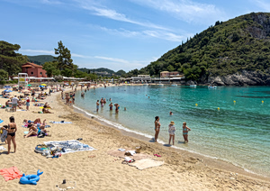
Most islands will remain mostly clear, with plenty of sunshine and only temporary cloud cover. Some local rain is possible in the Ionian Sea region.
Temperature drop and stronger winds
Temperatures will decrease across Greece, with the change expected to be more noticeable in western, central and northern areas.
In most parts of the country, temperatures will reach 27 to 29 degrees Celsius, while eastern mainland areas, the eastern Aegean islands, the Dodecanese and Crete may locally reach 30 to 32 degrees Celsius.
Winds will mainly come from northern directions, reaching 3 to 5 Beaufort and strengthening locally to 6 or 7 Beaufort in northern areas from the afternoon.
Weather forecast for Athens and Thessaloniki
In Athens, the day will begin with sunshine and a few clouds, but cloud cover will increase quickly. Local showers and thunderstorms are expected from the afternoon, with conditions improving overnight.
Temperatures in the capital will range between 21 and 31 degrees Celsius, while winds will shift to northern directions later in the day.
In Thessaloniki, cloudy conditions are expected, with rain and thunderstorms becoming locally strong from midday. Improvement is forecast during the evening. Temperatures will range from 19 to 27 degrees Celsius.
Gradual improvement from Sunday
On Saturday, instability will remain mainly in eastern mainland areas, Evia, the Sporades, northern Aegean islands, the Cyclades and Crete, where rain and scattered thunderstorms are expected.
Some storms may remain strong, particularly in Halkidiki during the early morning hours and in the Sporades and Evia until midday, before gradually weakening.
By Sunday, June 14, weather conditions are expected to improve across most of Greece, with generally clear skies and sunshine. Some local instability may remain in eastern mainland mountain areas and Crete during the warmer hours of the day.
The Peloponnese will be an exception, with increased cloud cover and occasional local showers or rain expected.
Temperatures are forecast to rise slightly on Sunday, mainly in western and northern Greece.