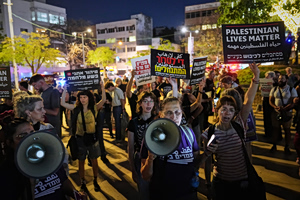
New maps issued by Israel to aid organizations in mid-March outline an expanded restricted zone in Gaza, marking an area that aid groups say places thousands of displaced Palestinians inside shifting boundaries the military says are necessary for operational coordination.
The maps, which were not publicly released by the Israeli military but shared with humanitarian organizations, show an “orange line” that defines an expanded restricted area beyond the “Yellow Line” established under an October ceasefire. According to Palestinian researchers and aid sources, the combined zones now cover nearly two-thirds of Gaza’s territory.
#Israeli maps outline expanded zone of military control in #Gaza
Read More : https://t.co/lEdHsvrHy9#ARYNews pic.twitter.com/M3RP7EB8jc
— ARY NEWS (@ARYNEWSOFFICIAL) April 30, 2026
Israel says the restricted areas are intended to enable humanitarian coordination while safeguarding operations, and that civilians are not affected. The military agency COGAT stated that the boundaries are determined and updated based on operational assessments, and that aid organizations must coordinate movements within these zones.
Aid sources said the updated maps were sent in mid-March, replacing earlier versions issued after the October ceasefire. Those earlier maps had already indicated an expanded zone, but the latest version introduced the orange line marking an even broader restricted area, as reported in Reuters. Israeli authorities declined to comment on whether the Yellow Line itself had been moved forward.
The expanded designation has raised concerns among displaced Palestinians and aid workers about access to humanitarian services and uncertainty over where safe movement is permitted. One resident in a displacement camp near Gaza City described confusion over shifting boundaries, saying people “do not know what is what” as lines appear to change without warning.
Aid groups report that at least three humanitarian workers have been killed in the area between the lines since mid-March. Israel’s military said in those cases it had identified threats near the Yellow Line and responded with fire.
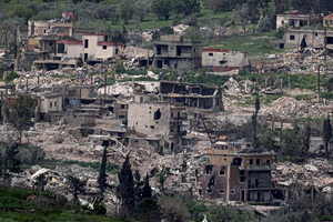
Local officials and aid representatives say the expanded zones have complicated relief efforts, with some areas seeing reduced access to water and supplies due to coordination concerns. The Palestinian NGOs Network in Gaza said residents face ongoing uncertainty over the limits of the restricted areas.
According to Palestinian researchers, the mapped zones now leave Israel in control of an estimated 64% of Gaza’s territory, confining much of the population to a smaller coastal area. Israeli officials have described such areas as buffer zones intended to prevent further attacks following the October 2023 Hamas-led assault.
COGAT said the restricted areas remain “sensitive and dangerous operational environments” and that signs have been placed warning against approaching them. Aid organizations, however, say the lack of clear public demarcation contributes to confusion among civilians living near the shifting boundaries.