An overflowing lake formed by a landslide on the Nepal-China border began spilling over on Friday, threatening areas already devastated by this week’s flash floods and forcing rescue teams to pause their work, authorities said.
Narendra Pariyar, the top official in Nepal’s hard-hit Rasuwa district, said his office had received notice that the lake had broken its banks and that river levels were visibly rising. Reuters reported that residents in Rasuwa were seen fleeing to higher ground as they braced for the surge.
Because of the risk of a lake burst, Chinese state broadcaster CCTV said all Chinese rescue personnel had been ordered to retreat to safety, while a Nepali army official told Reuters that rescue operations in Nepal were paused for 90 minutes.
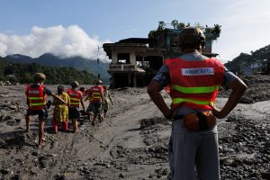
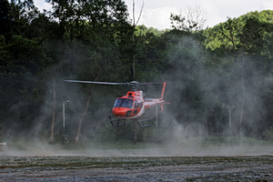
Rescuers have been working urgently to locate hundreds of people still missing, two days after a catastrophic flash flood tore through the Himalayan border area shared by Nepal and China. Nepal police said Friday morning the country’s death toll had climbed to 469, up from 390 the day before. China’s death count remains unchanged at three in Tibet. Together, the two countries say more than 1,000 people are still missing, including as many as 540 foreign nationals from over 30 countries.
China’s Assessment of the Lake Threat
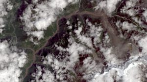
Wednesday’s disaster was triggered by a glacier collapse that sent rock and meltwater surging downstream, leaving behind a new hazard: a barrier lake formed by debris dams upstream.
China’s Ministry of Water Resources said the lake held about 2 million cubic meters of water as of Thursday, with another 3 million cubic meters expected to flow in over the following three days, roughly equivalent to 1,200 Olympic swimming pools, with peak flow expected around September 1.
According to CCTV, the lake’s debris barrier sits more than 10 kilometers from Gyirong Port, the border crossing that was overwhelmed by the initial flood, and about 1,000 meters higher in elevation.
China deployed an eight-person engineering team to survey the lake from the air and build 3D models of the site. Engineer Chen Hanxiao told CCTV the terrain has been difficult to navigate, since the glacier collapse left behind numerous isolated and steep cliffs around the lake.
He said the team’s general approach is to dig a drainage channel at a lower point along the dam, though the exact dimensions will depend on calculations of water flow and how fast the lake continues to fill. The survey found the lake measures roughly 150 meters long and 40 to 50 meters deep. Ongoing rain in the region, forecast to continue through the coming week, has further destabilized the surrounding soil and rock.