The return of El Niño is imminent, according to the United Nations, bringing to an end prior speculation of its possible return.
After a relatively calm La Niña phase and a brief neutral period, the return of El Niño now appears all but certain, with the United Nations issuing an urgent call for governments, health systems, and agricultural sectors to begin preparations immediately.
The World Meteorological Organization’s latest El Niño/La Niña Update puts the probability of an El Niño event forming between June and August 2026 at 80%, with the likelihood of it persisting through at least November climbing to 90% or above. While some uncertainty remains about the event’s peak strength and timing, most forecast models suggest it will be at least moderate and possibly strong.
WMO climate prediction chief Wilfran Moufouma Okia stated that after a period of neutral conditions at the start of the year, climate models are now strongly aligned and there is high confidence in the onset of El Niño, with further intensification expected in the months that follow.
NOAA’s Climate Prediction Center has also issued an El Niño Watch, estimating an 82% chance of El Niño emerging in the May to July 2026 window, with a 96% chance of it continuing through the Northern Hemisphere winter of 2026-27.
UN Secretary-General António Guterres issued a stark warning, saying that El Niño conditions will pour fuel on the fire of a warming world, a with impacts that will hit harder, travel farther, and cross borders with devastating speed.
What Is El Niño, and Where Did the Name Come From?
El Niño is not a modern discovery. It was first noticed by Peruvian fishermen in the 1800s, who observed that around Christmas each year, unusually warm ocean water would displace the cold currents off their coast. They named the phenomenon El Niño, Spanish for “the child,” a reference to the Christ Child given its timing near the holiday. The arrival of warmer water was bad news for their livelihoods: the anchovies that sustained the local fishing industry depend on the cold, nutrient-dense upwelling driven by the Humboldt Current, and when that current weakens, the fish disappear.
The temperature contrast these currents create is striking. The Chilean port city of Antofagasta and Rio de Janeiro in Brazil sit at virtually the same latitude along the Tropic of Capricorn, yet average sea surface temperatures between the two cities differ by roughly six degrees Celsius, with Antofagasta’s Pacific waters running far colder due to that current.
The Record Breakers: 1982, 1983, and 1997
The scientific world got a vivid reminder of El Niño’s destructive potential in 1982-83, when the strongest event of the 20th century up to that point lashed the globe with catastrophic results: flooding across the American Pacific coast and the southern US, devastating droughts in northeastern Brazil, Indonesia, and parts of Africa, and an abnormally mild winter across mid-latitude Europe, Asia, and North America.
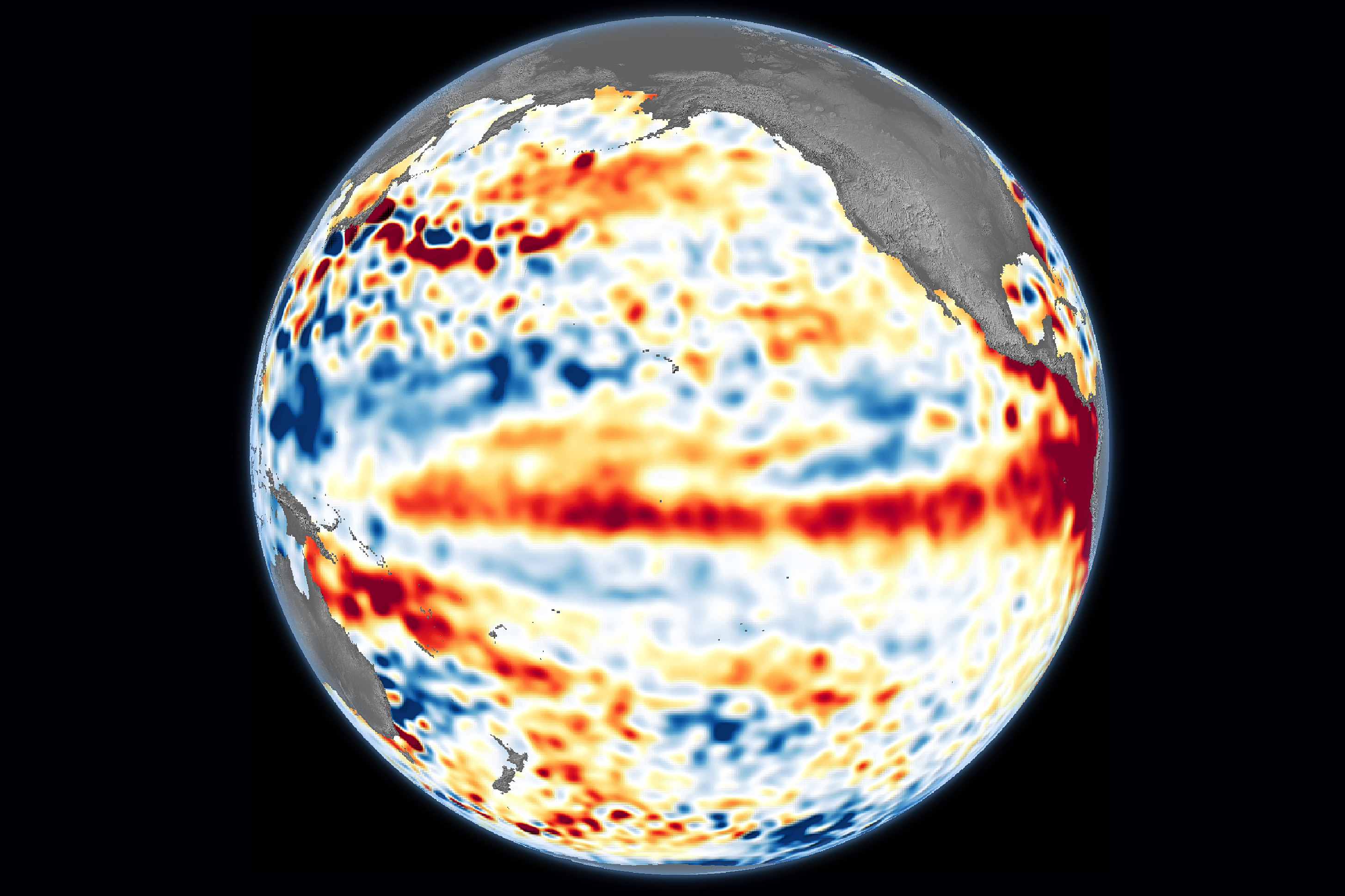
The El Niño’s Effects in 1982-83. Credit: Wikimedia Commons
That record did not stand for long. The 1997-98 El Niño is now regarded as one of the most powerful ENSO events in recorded history, resulting in widespread droughts, flooding, and other natural disasters across the globe. It caused an estimated 16% of the world’s reef systems to bleach and die, temporarily warmed global air temperatures by 1.5 degrees Celsius above the usual El Niño contribution of 0.25 degrees, and led to global economic losses estimated at US$5.7 trillion within five years.
What a “Super El Niño” Actually Means
The phrase “super El Niño” has been circulating in recent forecasts, but it has a specific technical meaning. A super El Niño occurs when average sea surface temperatures in key parts of the Pacific rise by two degrees Celsius or more above normal. The term is not an official designation of any meteorological agency, but an informal descriptor used by some forecasters.
Scientists believe that the combination of El Niño and the already elevated baseline of global warming could push 2027 toward becoming the hottest year ever recorded. The UN has separately warned there is a 75% chance that average temperatures between 2026 and 2030 will surpass the 1.5 degrees Celsius threshold above pre-industrial levels.
Where the Impacts Will Be Felt
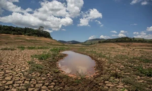
The global footprint of a strong El Niño is well-mapped from past events. The Andean nations of South America, Argentina’s Atlantic coast, East Africa, and parts of the southern United States tend to see above-average rainfall and flooding risk.
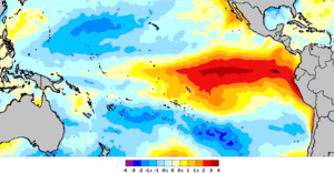
El Niño’s Effects: Weather Patterns and Consequences in Latin America – Credit: Media Ninja / CC BY 4.0
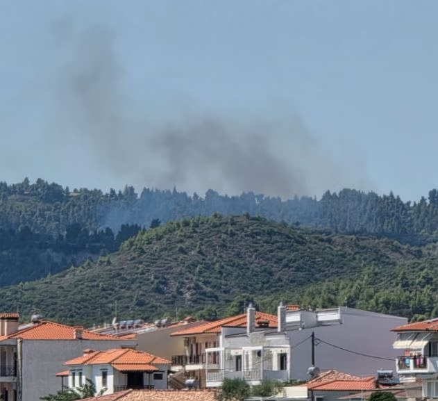
In contrast, Southeast Asia, parts of Australia, and northeastern Brazil face heightened drought conditions, with knock-on effects for agriculture, wildfire risk, and water supply. A typical El Niño also tends to bring warmer and drier winters to the northern United States while making the southern states wetter and colder
For the Mediterranean, the signal is more muted. The region’s enclosed geography and complex terrain weaken the ENSO teleconnection compared to other parts of the world. Still, a very strong event is likely to push temperatures above seasonal norms and raise the probability of localized extreme rainfall, adding further pressure to a region already grappling with chronic water stress and an increasing frequency of summer heatwaves.
A Window to Prepare
Unlike a hurricane or earthquake, El Niño provides months of advance warning, which is precisely why the WMO publishes regular updates and why the latest one was accompanied by calls for action rather than just observation. Governments, farmers, health authorities, and water managers have tools available to them. As one UN official noted following the 1997-98 event, awareness of El Niño and what it can do to societies and economies is now high, and the time between events is the right time to improve understanding and devise better ways to cope with its direct and indirect effects.
What was once a curiosity noticed by fishermen on a remote stretch of coastline is now one of the most consequential and closely watched drivers of global weather, and its next chapter is already underway