Santorini and the surrounding Cycladic islands are no strangers to seismic unrest. Over the past few days, the region has been rattled by hundreds of earthquakes, with magnitudes exceeding 4.0 on the Richter scale. While authorities stress that these tremors are tectonic and not volcanic, the activity has reignited concerns about the region’s seismic past—particularly the devastating 1956 Amorgos earthquake, the most powerful quake to hit Greece in modern history.
The 1956 Amorgos Earthquake: What Happened?
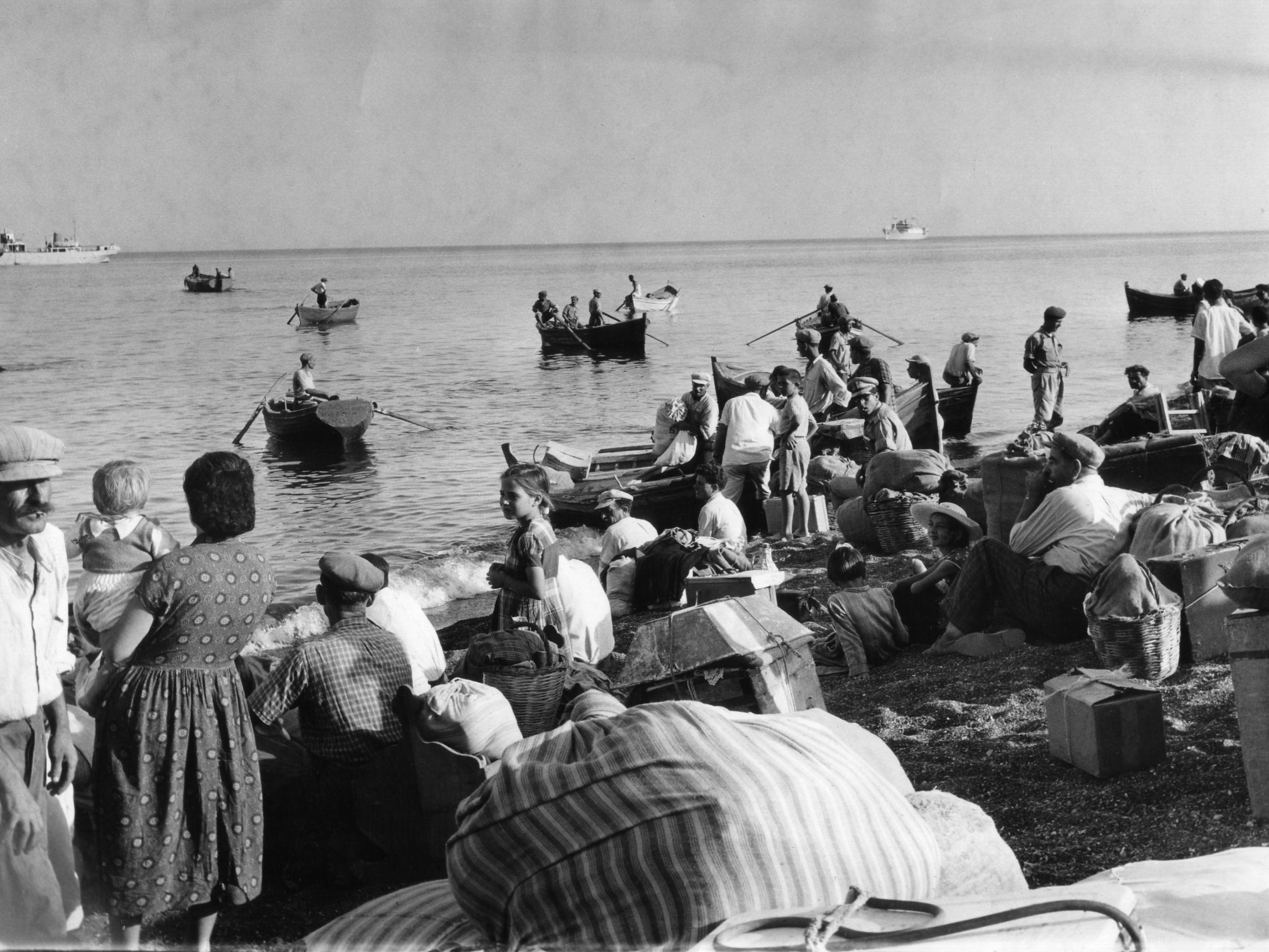
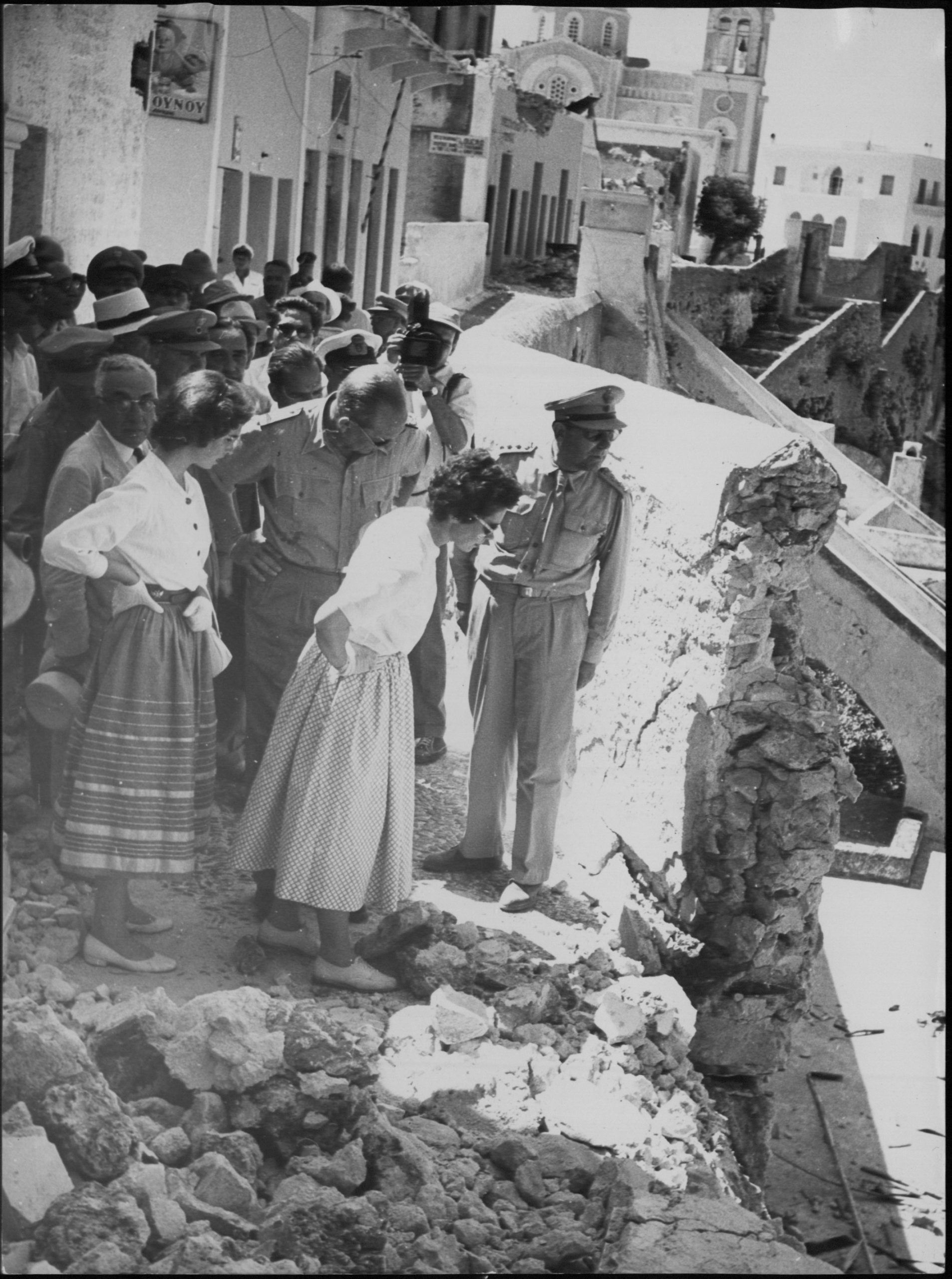
On July 9, 1956, a powerful earthquake with a magnitude ranging between 7.2-7.8 struck just south of Amorgos, triggering a tsunami that remains the largest recorded in the Mediterranean in the past two centuries. Entire villages crumbled, more than 3,200 buildings were damaged, 500 were destroyed and 54 people lost their lives in Santorini alone. The extent of damage on Amorgos is not clearly documented. The twin disasters left an indelible mark on Greece and serve as a grim reminder of the region’s vulnerability to seismic activity.
Recent scientific investigations have shed new light on the fault responsible for the 1956 quake. A 2024 study in Nature identified a 75-km-long seafloor rupture along the Amorgos Fault, with an offset reaching up to 16.8 meters—evidence of the massive displacement that triggered both the quake and tsunami.
The quake’s epicenter was located 5-20 km south of Amorgos, with a depth estimated at ~25 km. Just 13 minutes later, a powerful aftershock ranging between 6.0-7.2 struck near Santorini, further compounding the damage.
The tsunami, with waves reaching 20 meters high along Amorgos’ southern coast, also caused damage on Astypalaea due to an estimated 10 meters high wave, as well as on Crete, and western Turkey. Historical records even describe the sea retreating completely from Amorgos’ Katapola harbor, allowing people to walk across the seabed before the waves came crashing back.
Could a Similar Quake Happen Today?
Seismologists, including Efthymios Lekkas, emphasize that the recent Santorini-Amorgos seismic activity is not linked to volcanic movements but rather to tectonic shifts along regional faults. Scientists cannot rule out a larger earthquake, with most estimating the possibility of a magnitude 5.0–5.5 event, though a repeat of the 1956 disaster is unlikely.
Interestingly, the Santorini-Amorgos Fault remains unbroken since 1956, raising concerns about potential stress buildup. Experts warn that while Santorini’s seismic activity is often linked to magma movements beneath its caldera, the Amorgos Fault is purely tectonic—meaning stress could be accumulating over decades.
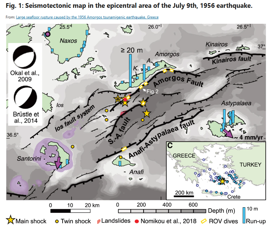
Several epicenters for the main shock (star) and twin shock (dot) are represented, as summarized in Brüstle et al.13, with two proposed focal mechanism13,14 calculated for the epicenter marked with a star and an asterisk. Main faults are represented by black lines, with thicker traces for longer and taller faults, and are modified from previous works19,29,33. S.-A. fault: Santorini-Amorgos fault. Portions of faults explored with the ROVs during the AMORGOS-23 cruise are localized by yellow and white rectangles. Submarine landslides identified25 are in dashed red, while the observation19 of a probable fault mirror associated with the 1956 event along the Amorgos fault is a red dot. Measured run-ups14 of the 1956 tsunami are represented as blue bars. In the inset, other tsunami observations of the 1956 event are located by blue14 and white20 dots. Light purple areas are onshore and offshore volcanoes. The purple arrows on Astypalaea and Santorini show their relative displacements southeastward and southwestward, respectively, at a rate of ~4 mm/yr, with respect to central Aegean (Naxos)31. Mount Kroukelos on Amorgos is denoted by a black triangle. The two archeological sites that demonstrate long-term subsidence of the northern coast of Amorgos18 are located in Katapola (K.) and Aegiali (A.). Source: https://www.nature.com/articles/s43247-024-01839-0/figures/1
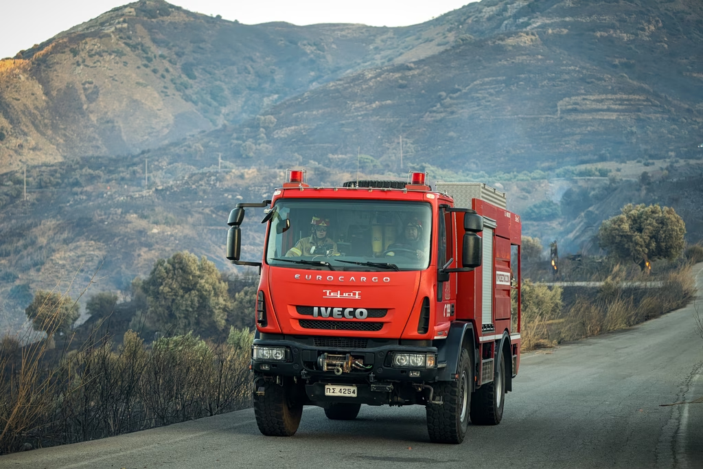
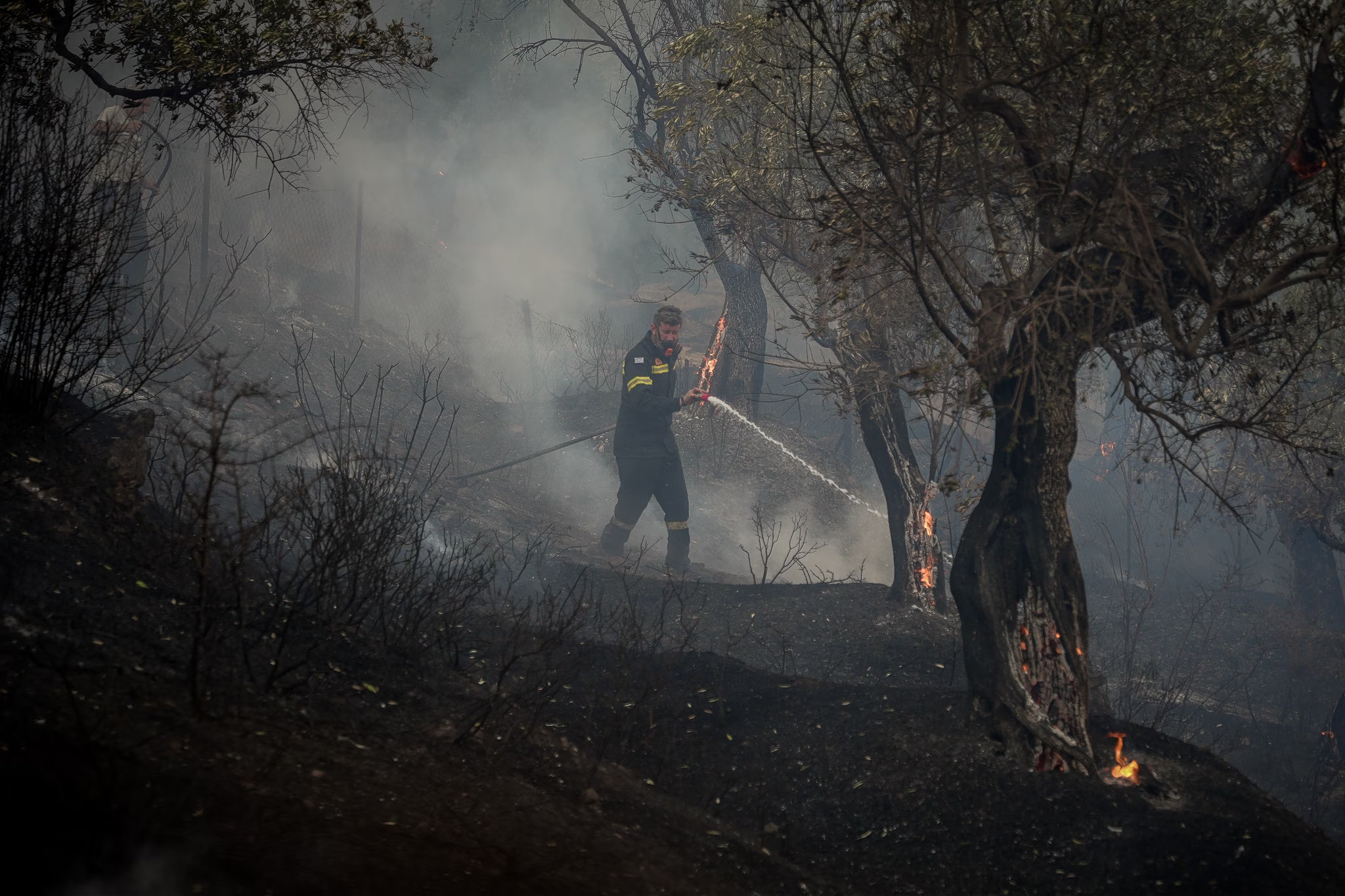
The UK has already issued a travel advisory for Santorini due to the ongoing tremors, media reports that residents of Santorini have been departing the island in droves via ferry and plane, and Greek authorities have deployed emergency response teams across the region.
Lessons from 1956: Is Greece Prepared?
Greece has vastly improved its earthquake preparedness since 1956, with stricter building codes, early warning systems, enhanced monitoring of fault movements, and evacuation points declared on islands. However, the tsunami risk remains a concern, as no comprehensive evacuation plan currently exists for the Cycladic islands.
Authorities have closed schools in Santorini, Anafi, Ios, and Amorgos, restricted access to unstable coastal areas, advised the public to avoid abandoned buildings, and told fisheries to keep their boats at dock while the risk is still high. Meanwhile, scientists and authorities continue to monitor the situation closely, aiming to ensure that if history does repeat itself, the country will be ready.