Greek authorities have placed several regions under a “red code” emergency alert as a powerful wave of severe weather is expected to hit the country from the early hours of Sunday, February 1, 2026.
Following an emergency weather bulletin from Greece’s national meteorological service, the General Secretariat for Civil Protection announced heightened readiness for large parts of Macedonia, Thessaly and the Peloponnese. Forecasts warn of intense rainfall, thunderstorms, gale-force winds and extensive snowfall, with conditions expected to persist through Monday.
Emergency meeting and risk assessment
An extraordinary meeting of the national Risk Assessment Committee was convened on Saturday by the head of Civil Protection, in the presence of the minister responsible for climate crisis and civil protection. The focus was on evaluating the intensity and duration of the expected phenomena, particularly during Sunday and Monday.
According to scientists advising the committee, the most severe conditions on Sunday are forecast for the Peloponnese, Thessaly—including coastal and island areas nearby—and parts of northern Greece. These areas face a combination of heavy rain, thunderstorms and snow, raising the risk of flooding, transport disruption and other weather-related impacts.
Regions under “red code” alert
After the meeting, Civil Protection placed the following areas under maximum readiness status:
- The Peloponnese region
- Thessaly, including nearby island groups
- Parts of western Greece
- Sections of central and northern Greece
Local and regional authorities have been instructed to activate emergency coordination bodies to ensure rapid response if conditions deteriorate.
Widespread severe weather elsewhere
Other parts of the country, including Crete, western coastal islands, mainland central regions and the wider Athens area, are also expected to experience intense and long-lasting rainfall and storms. These areas are under an orange-level warning, indicating significant risk but slightly lower intensity than red-alert zones.
By Monday, the focus of the storm system is expected to shift eastward, bringing heavy rain and thunderstorms to parts of the eastern Aegean and southern islands during the morning hours.
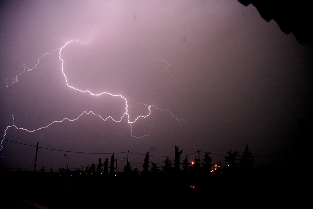
Meteorologists warn of persistent phenomena
Meteorologist Giorgos Tsatrafyllias described the system as a “significant weather event” marked by persistent storms, cyclonic winds, frequent lightning and localized hail. He also warned of the potential for whirlwinds in areas where local geography may intensify conditions.
Snowfall is expected to be extensive across central and northern Greece, affecting not only mountainous areas but also semi-mountainous zones. In northeastern parts of the country, snow may fall at relatively low elevations.
Advice to the public
Authorities are urging residents to avoid unnecessary travel, particularly in areas with a history of flooding or landslides. Emergency services and local governments have been placed on heightened alert, while citizens are advised to closely follow official updates from Civil Protection and meteorological authorities as the situation develops.