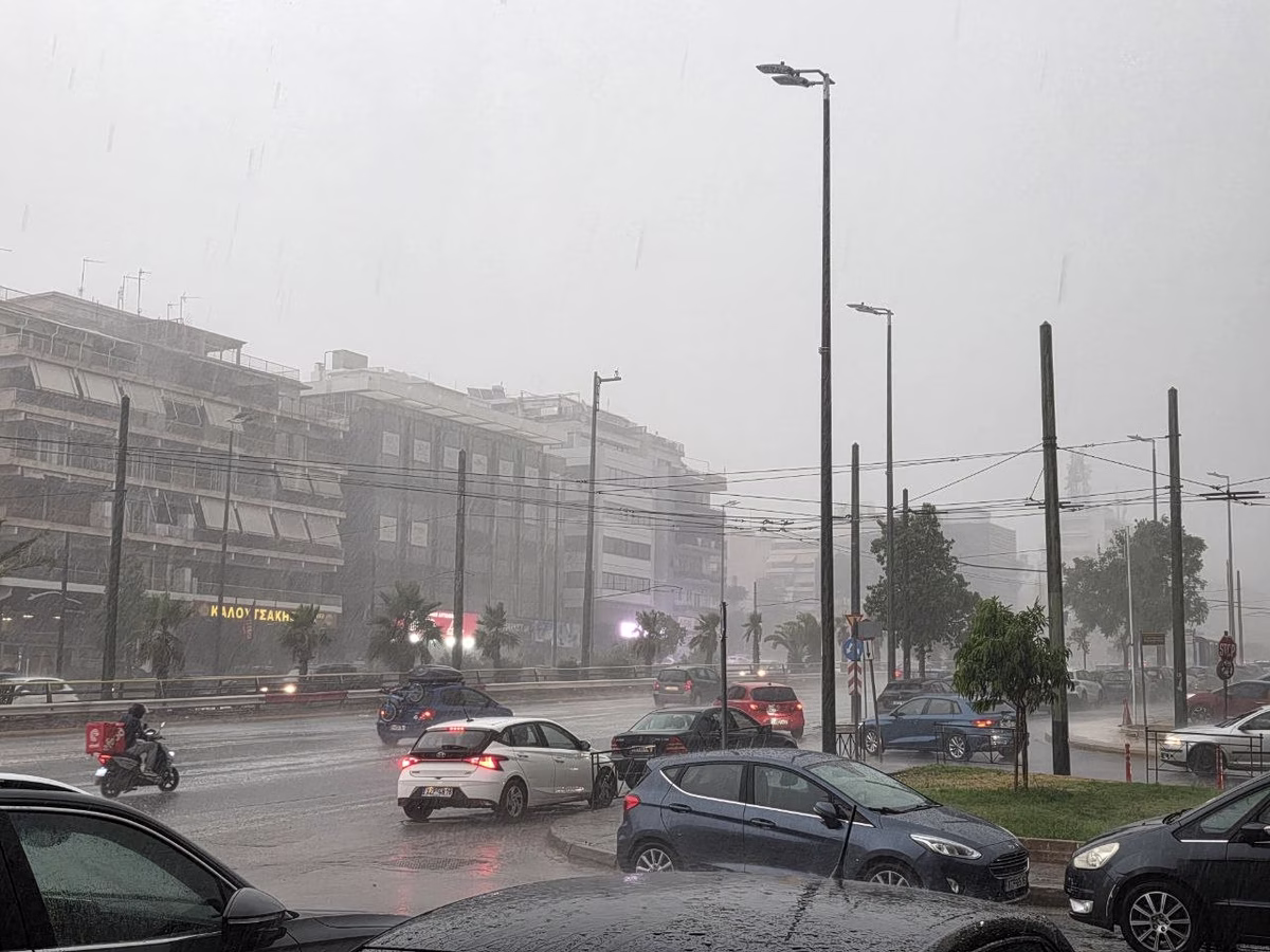

Severe winter weather continues to affect large parts of Greece on Tuesday, with meteorologists warning of storm-force winds, heavy rainfall and an increased risk of flooding, particularly in the wider Athens area. The unsettled conditions are being driven by the clash of cold air masses over Greece with warmer, moisture-rich air moving in from the central Mediterranean.
The deterioration is expected to become more pronounced later in the day and overnight, while cold temperatures persist, especially in northern regions. Forecasters are warning that extreme weather phenomena may impact several areas, prompting authorities to issue alerts for both land and sea transport.
Gale-Force Winds and Disrupted Sea Travel
Very strong easterly winds are sweeping across western and southern parts of the country, including coastal and maritime areas, reaching up to 10 on the Beaufort scale. As a result, ferry services have been disrupted, particularly in western Greece.
According to the Hellenic Coast Guard, some high-speed ferry routes are operating only at the discretion of ship captains, depending on real-time weather conditions. Certain ferry connections have been suspended altogether, while passengers are advised to contact port authorities and ferry companies before traveling.
Strong winds have also led to the suspension of a key ferry crossing linking mainland Greece, while authorities have issued warnings for drivers crossing a major suspension bridge in western Greece. Heavy vehicles have been temporarily halted, and motorists are urged to follow official instructions closely.
Snowfall and Road Conditions
Snowfall has already covered mountainous areas north of Athens, creating a winter landscape while roads remain open under close monitoring. Drivers are advised to carry snow chains, as conditions may worsen.
In central Greece, traffic disruptions and mandatory use of anti-slip chains have been reported on several mountain roads due to snow and frost. Authorities have reminded drivers that winter equipment is compulsory on many routes when vehicles are not fitted with special tires.
Rain, Snow and Falling Temperatures Nationwide
Meteorological forecasts indicate intermittent rain across much of the country, with snowfall expected in mountainous and semi-mountainous regions. In northern areas, snow may fall at relatively low altitudes, while central and southern regions will see a mix of rain, storms and mountain snow.
Temperatures remain low, particularly in northern Greece, where morning and evening frost is expected. Winds will remain strong across sea areas, adding to travel difficulties.
Athens and Thessaloniki Outlook
In the Athens region, local rain is forecast along with snowfall at higher elevations. Temperatures are expected to range between 5 and 11 degrees Celsius, while authorities warn that intense rainfall on Wednesday could lead to localized flooding, especially in central and western parts of the metropolitan area.
In Thessaloniki, cloudy conditions are expected, with temperatures ranging from below freezing in the early morning to around 8 degrees Celsius during the day.
More Severe Weather on Wednesday
Wednesday is expected to bring a fully wintry scene, with widespread rain and thunderstorms across much of the country and heavy snowfall in mountainous areas. In some regions, snow may reach lower elevations, potentially affecting cities in northern and central Greece.
The most intense phenomena are forecast for southern and eastern parts of the country, with Athens likely to be significantly affected from morning through afternoon. Weather conditions are expected to gradually ease from Wednesday night onward, with winds weakening and temperatures slowly rising from Thursday.
Despite gradual improvement later in the week, meteorologists warn that rain will persist in western Greece and parts of the Aegean Sea for several days. Authorities continue to urge caution, particularly for travel, as Greece remains under the grip of a powerful and volatile winter weather system.