An ancient Etruscan harbor structure dating to the 4th century BC has been found submerged at a depth of less than two meters, just 130 meters from the sanctuary of Punta della Vipera. The discovery was made by a team of underwater archaeologists and geologists from Rome’s Sapienza University and the Center for Marine Studies, off the coast of Santa Marinella, north of Rome. According to the researchers, the remains of an ancient quay and pier represent the oldest known evidence of a mooring site linked to an Etruscan temple.
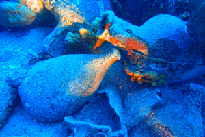
The structure runs roughly 60 meters parallel to the coast and another 35 meters out to sea, forming an L-shaped layout that shelters a basin of about 3,000 square meters. The stone blocks lie on the seabed at depths of half a meter to two meters, covered in marine vegetation.
The discovery, published in the Journal of Cultural Heritage, was made possible through a shallow-water survey using drones and light diving equipment. The location of the harbor complex, just 130 meters from the Punta della Vipera temple, along with its construction technique, points to a date before Roman rule. The remains stayed hidden due to rising sea levels, which placed the ancient coastline more than a meter below today’s shoreline.
Mapping work identified two main alignments of cut stone blocks. The first, perpendicular to the shore, starts at the wall of a modern private villa and extends into the sea, built on a natural rock outcrop. On top of this, the Etruscans placed squared stones to create a stable quay.
The second alignment, running parallel to the coast, consists of two rows of cut stones filled inside with rocks and pebbles, forming a breakwater. Notably, a narrow channel just 0.6 meters wide cuts through the parallel pier, allowing water circulation and preventing silt buildup. Next to the channel, a large, eroded block served as a wave-breaking platform.
Technical Features and Function of the Harbor
The complex also includes a circular cluster of stone blocks at the northwestern end of the parallel pier, possibly a tower or mooring platform, similar to others found in North Africa. The sheltered basin provided room to maneuver boats between 15 and 20 meters long, supporting coastal traffic between Etruscan cities and the wider Mediterranean.
To date the structure, researchers used the current depth of the remains along with the height the pier would have needed. The data show that sea levels were 1.2 to 1.4 meters lower than today, placing the harbor’s construction between the 6th and 3rd centuries BC. The use of cut calcarenite blocks without hydraulic mortar further points to a pre-Roman origin.
Link to the Sanctuary of Punta della Vipera
The temple at Punta della Vipera, dedicated to the goddess Minerva (Athena), had its entrance facing the sea, suggesting worshippers arrived by boat and climbed to the sanctuary along a sacred path. Excavations at the temple uncovered Phoenician and Carthaginian coins and tiles identical to those found on the harbor basin’s seabed, confirming the link between the temple and the port.
The harbor served religious purposes as well as trade and military activity. Pilgrims brought votive offerings, including clay anatomical models, seeking healing from the goddess. The layout of the complex reflects a unified design rarely seen elsewhere in the Etruscan world.
Reuse and Abandonment
The remains visible today represent only part of the original structure, since many blocks were removed and reused in later periods. The losses are greater in easily accessible areas, while the foundation row of stones survived because it was harder to remove. The destruction coincided with the construction of a Roman rural villa in the late 1st century BC, with some stones likely carried off to the nearby Guardiole fish farm.
Despite the damage, the harbor follows a technical model known from the Phoenician and Greek Mediterranean, recalling the ports of Tyre, Sidon, Atlit, and Amathus in Cyprus.
New Evidence on Etruscan Sea Power
Ancient texts praise the naval strength of the Etruscans, but their port infrastructure has remained poorly documented until now. This discovery changes that picture, placing the region at the center of trade routes linking Etruscan cities to Sardinia, Italy, and North Africa. The presence of Carthaginian coins suggests that ships from Carthage anchored at this very pier.
Researchers say further study is needed, as the findings may represent the earliest known evidence of a mooring site tied to an Etruscan temple. For now, the harbor at Punta della Vipera remains underwater, a silent record of an era when the sea served as a sacred pathway for the Etruscans.