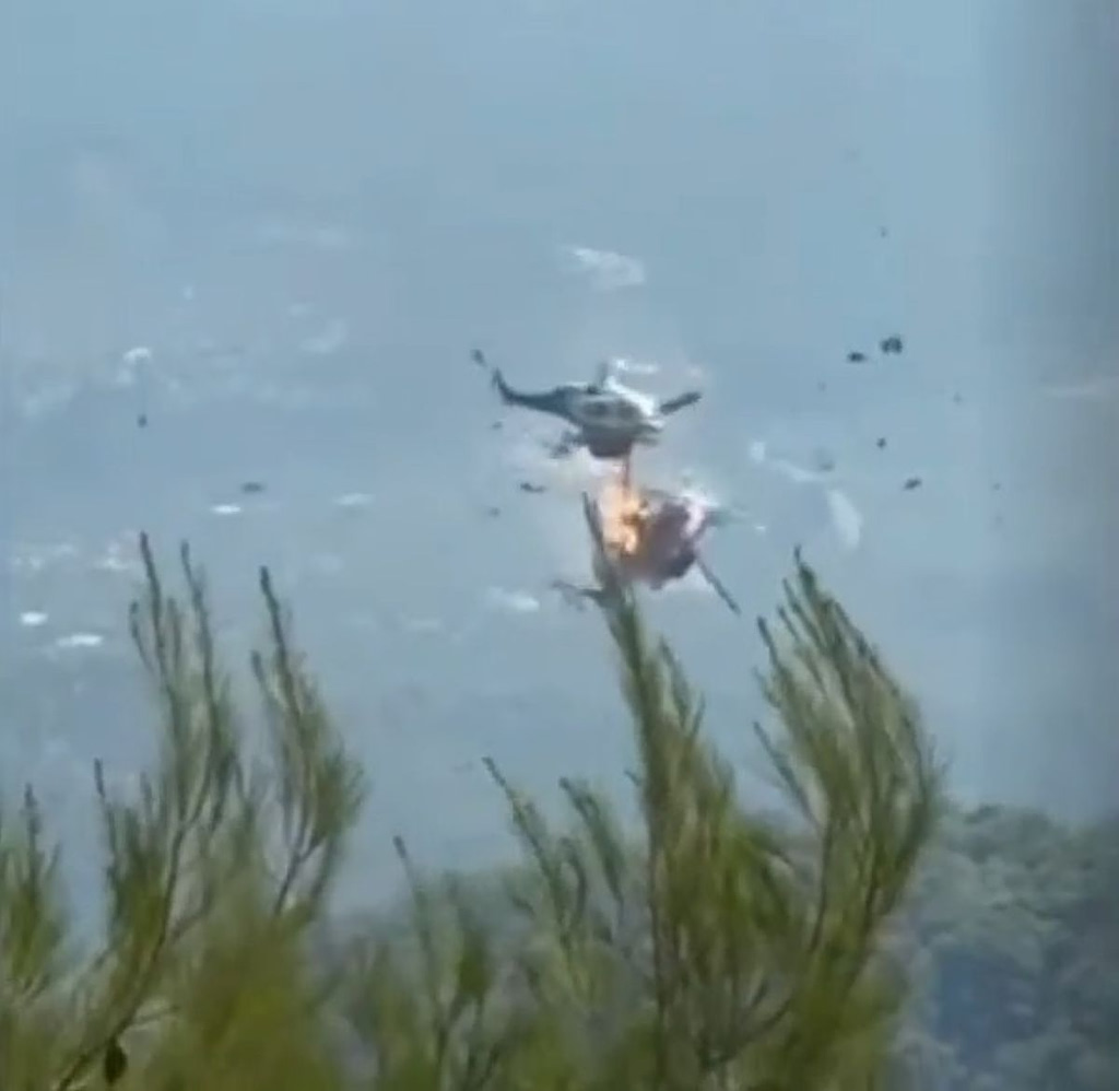
Greece has approved its first National Forest Fire Risk Assessment Map in more than 40 years, a move officials described as a landmark reform that will reshape the country’s approach to wildfire prevention and preparedness.
Climate Crisis and Civil Protection Minister Giannis Kefalogiannis said the new map provides a “modern, scientifically documented tool that reflects the real conditions of the climate crisis and facilitates planning in a targeted manner, with transparency and measurable results”.
Announced following the signing of a Joint Ministerial Decision on Monday by Kefalogiannis and Environment and Energy Minister Stavros Papastavrou, the map replaces a regional fire-risk classification system first established 45 years ago, one that authorities say no longer reflects today’s dramatically altered climatic and environmental conditions.
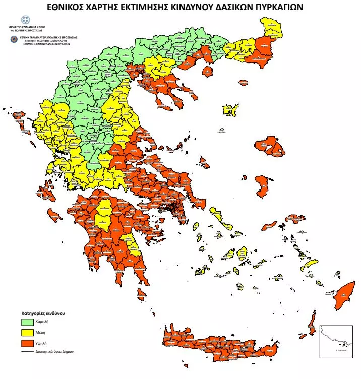
Unlike the Daily Fire Risk Forecast Map issued during the fire season, the new national map makes location-specific assessments. Municipalities (instead of prefectures) across Greece are now categorized into three risk levels: low, medium, and high, based on vegetation type, climate conditions, and other environmental factors.
Officials say this classification will enable precise planning, specialized prevention measures, and a more rational and equitable allocation of fire-protection resources.
Kefalogiannis described the map as a reform “that invests in prevention and in understanding risk with the greatest possible accuracy”.
“We are giving municipalities a strong and objective framework that prioritizes fire-protection projects so that resources can be directed where the danger is greatest. A step that strengthens our resilience and enables us to be better prepared in the future,” he added.