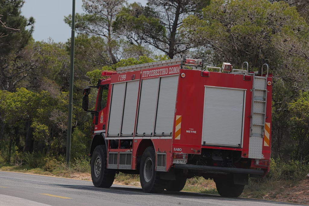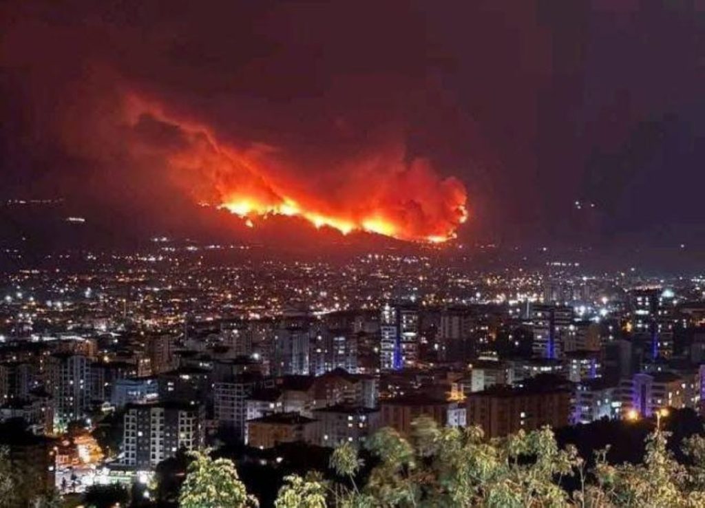

Nearly 1,040 acres of land (approximately 4,200 hectares) have been destroyed by wildfires in Greece, according to satellite imagery released by Meteo, the weather service of the National Observatory of Athens. The fires have severely impacted the regions of Kythira, Evia, and Kryoneri in Attica.
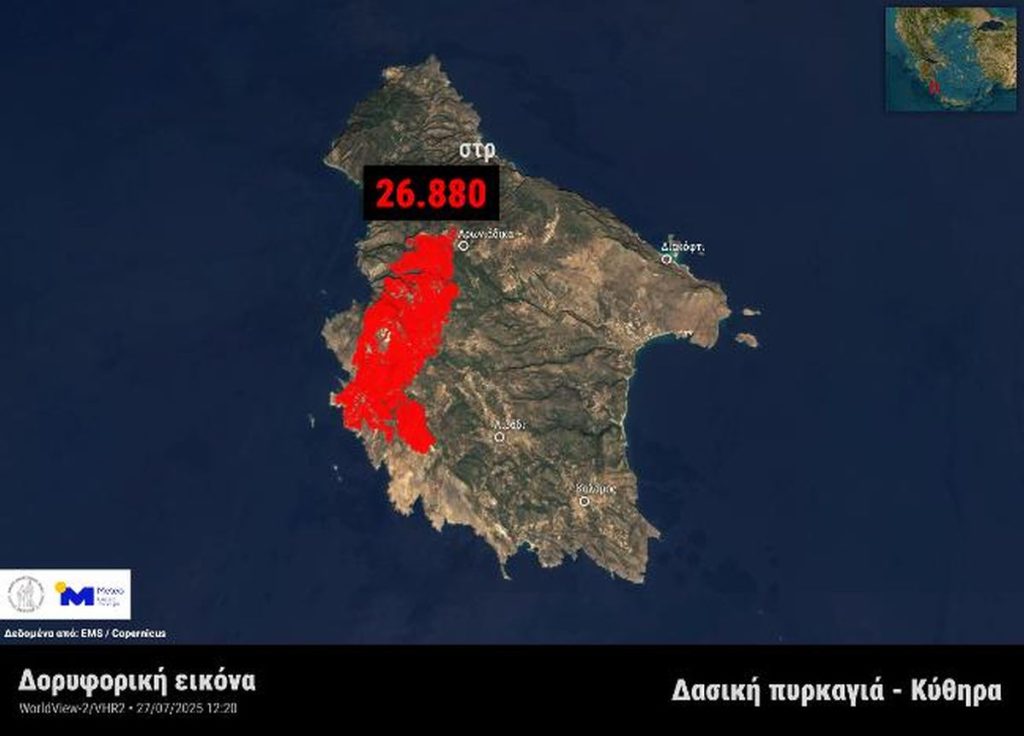
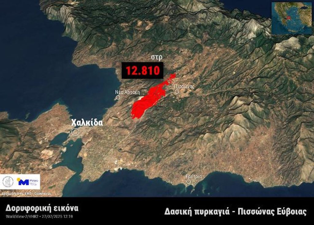
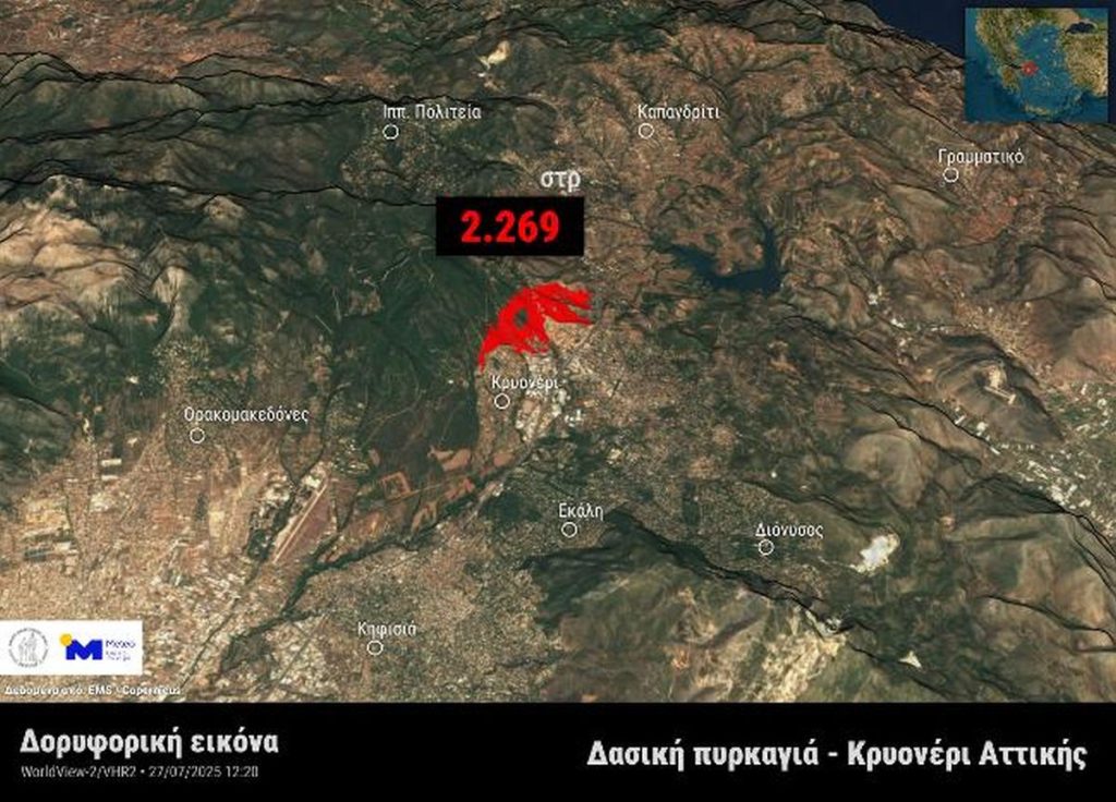
The data was collected using very high-resolution satellite images from the WorldView-2 satellite (sensor VHR2), which passed over the affected areas at midday on Sunday, July 27, 2025.
According to analysis from the European Copernicus Emergency Management Service (EMS), as of 12:20 PM on Sunday, the extent of burned land was estimated at:
- 26,880 stremmata in Kythira,
- 12,810 stremmata in Pissona, Evia, and
- 2,269 stremmata in Kryoneri, Attica.
The wildfires have caused extensive damage to natural ecosystems in these areas. This assessment, based on satellite surveillance, offers a detailed overview of the scale of destruction, underscoring the ongoing environmental threat posed by summer wildfires across Greece.