UNESCO has announced a new group of Global Geoparks across Europe, highlighting landscapes shaped by millions of years of geological activity—from volcanic systems and tectonic movement to erosion and glacial carving.
The designation, established in 2015, aims to protect and promote areas of geological significance while working closely with local communities and Indigenous populations. According to UNESCO, each site tells a story that predates human history and belongs to humanity as a whole.
“Every rock formation, every canyon and every fossil tells a story that belongs to all of humanity,” said UNESCO Director-General Khaled El-Enany, describing the importance of preserving geological heritage alongside education and scientific research.
This latest round of designations adds 12 new geoparks worldwide, including sites in China, Japan, Malaysia, Russia, Tunisia, and Uruguay. In Europe, several destinations stand out for their geological and cultural significance.
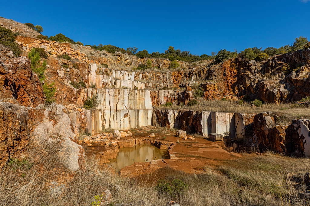
Terres d’Hérault Geopark, France
Located in southern France, the Terres d’Hérault Geopark spans more than 100 municipalities in the Occitanie region. Its landscapes include ancient marble quarries, river-carved valleys, and striking red rock formations dating back 250 million years.
Visitors can explore the area through marked hiking routes designed to showcase its geological diversity, including the Navacelles Cirque and Lake Salagou.
Nisyros Geopark, Greece
In the Aegean Sea, the island of Nisyros forms part of Greece’s Dodecanese island group and is defined by one of the country’s most active volcanic systems.
The geopark includes one of the best-preserved volcanic calderas in the region, along with lava domes, hydrothermal craters, and submarine volcanic centers. The Stefanos crater is among the largest of its kind in Europe.
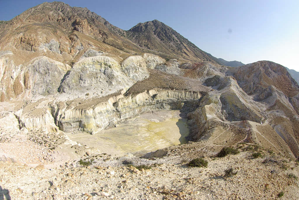
Volcanic rock has also shaped local architecture in villages such as Nikia and Mandraki, while the island’s soil supports rare and endemic plant species. Geotrails allow visitors to explore its volcanic landscape.
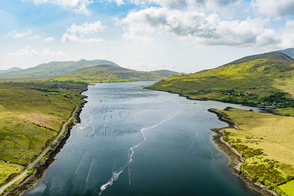
Joyce Country and Western Lakes, Ireland
Spanning parts of western Ireland, this geopark showcases landscapes shaped more than 450 million years ago by ancient mountain-building events.
Key features include karst terrain, glacial valleys, and Ireland’s only fjord at Killary Harbour. The region also incorporates Ireland’s Gaeltacht areas, where Irish is still spoken daily, and hosts traditional cultural festivals throughout the year.
Algarvensis Geopark, Portugal
In southern Portugal’s Algarve region, the Algarvensis Geopark reveals a geological history beyond its famous coastline.
Highlights include tsunami deposits linked to the 1755 Lisbon earthquake, the country’s deepest publicly accessible salt mine, and fossil-rich coastal cliffs dating back millions of years.
The initiative also aims to guide tourism beyond the beaches, encouraging visitors to explore inland villages and support local crafts and food traditions.