
Weather in Greece is set to deteriorate abruptly during the following hours of Monday, February 3. According to the emergency weather bulletin issued by the Hellenic National Meteorological Service (EMY), most areas of the country will experience rain and thunderstorms, with the phenomena forecasted to be even more intense on Tuesday, February 4.
The bulletin foresees that the weather will deteriorate from Monday (February 3, 2025), moving from west to east, bringing locally heavy rain and thunderstorms.
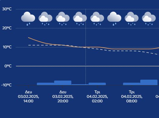
According to the forecast, the weather in Greece from Tuesday (February 4, 2025), will see strong winds prevaling in the east, and temperatures experiencing a sharp drop over the next three days.
More specifically, heavy rain and thunderstorms are expected on Monday, February 3, until the afternoon in the Ionian Sea (mainly in areas surrounding the islands of Kefalonia and Zakynthos as well as the western Peloponnese.
From late Monday evening until Tuesday morning, February 4, heavy rain and thunderstorms are also expected in eastern Central Greece, including Attica, Evia, eastern Thessaly, and the Sporadic Islands.
The phenomena will become present in the Cyclades and the eastern Aegean islands, from late Tuesday morning, February 4, onwards.
Strong northeasterly winds will develop on Tuesday (February 4) from the early morning hours until the afternoon in Thrace, the northeastern Aegean islands, the Sporades, and temporarily in eastern Thessaly and Evia.
From Wednesday, February 5 to Friday, February 7 gale-force northerly winds will persist in the Aegean.
Temperature drop:
On Tuesday, February 4, temperatures will decrease by 6-7°C in the north, while on Wednesday, February 5, the drop will extend across the entire country.