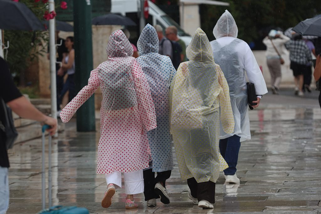
Locally severe weather conditions are expected Tuesday, mainly affecting western and central Macedonia and the region of Thessaly, according to the National Meteorological service.
Meteorologists are warning of potentially strong thunderstorms during the midday and afternoon hours in those areas. Across the rest of the country, partly cloudy skies are forecast, with cloud cover becoming denser in places, while visibility is expected to be limited early in the morning over western mainland regions.
Winds will blow from the north-northwest at 3 to 5 Beaufort, strengthening later in the afternoon to 5 to 6 Beaufort, while over the southern seas west-northwesterly winds could reach up to 7 Beaufort. Temperatures are not expected to change significantly, reaching up to 25 degrees Celsius in eastern mainland Greece and the Dodecanese islands.
Detailed Forecast by Region
Macedonia – Thrace
Cloud cover is expected across Macedonia, bringing local rain showers and storms, initially in western and central areas before spreading eastward. Thunderstorms may become locally intense. In Thrace, skies will start mostly clear, with clouds increasing from midday and bringing localized rainfall. Winds will turn southerly by noon at 2 to 4 Beaufort, while temperatures will range from 10 to 24 degrees Celsius.
NEWSLETTER TABLE TALK
Never miss a story.
Subscribe now.
The most important news & topics every week in your inbox.
Ionian Islands – Epirus – Western Central Greece – Western Peloponnese
Thin cloud cover will gradually thicken, bringing rain and showers mainly to Epirus and western Central Greece. Isolated thunderstorms are possible in mountainous areas. Winds will blow from the west-northwest at 4 to 6 Beaufort, with temperatures reaching up to 23 degrees Celsius.
Thessaly – Eastern Central Greece – Evia – Eastern Peloponnese
Mostly clear skies will quickly give way to increased cloudiness, with local rain showers and scattered thunderstorms expected. In Thessaly, weather phenomena could become particularly intense. Winds will initially be variable at 3 to 4 Beaufort before shifting west-northwesterly and strengthening up to 7 Beaufort. Temperatures will climb to 25 degrees Celsius.
Cyclades – Crete
Partly cloudy conditions are expected, with periods of denser cloud cover. Winds will blow from the west-northwest at 4 to 6 Beaufort, locally reaching 7 Beaufort. Temperatures will rise to around 24 degrees Celsius.
Eastern Aegean Islands – Dodecanese
Light cloud cover is forecast, with northerly winds at 3 to 5 Beaufort gradually intensifying. Temperatures will reach up to 25 degrees Celsius.
Attica
Clouds will increase throughout the day, with local rain showers expected in the afternoon and a chance of brief thunderstorms in northern parts of the region. Winds will start southerly at 2 to 4 Beaufort before turning northwesterly at 3 to 5 Beaufort. Temperatures will range from 15 to 25 degrees Celsius.
Thessaloniki
Increased cloudiness is expected, bringing local showers and scattered thunderstorms before conditions improve later in the afternoon. Winds will initially be variable at 2 to 3 Beaufort before shifting northwesterly at 4 to 5 Beaufort. Temperatures will range between 14 and 23 degrees Celsius.
The Outlook for the Coming Days
Wednesday, May 20
Cloud cover and local showers with isolated thunderstorms are expected in eastern Greece, while the rest of the country will see generally fair weather with temporary cloud development over mainland regions. Northwesterly winds will blow at 4 to 6 Beaufort, reaching 7 Beaufort in southern sea areas. Temperatures will rise slightly inland, reaching up to 27 degrees Celsius.
Thursday, May 21
Mostly clear weather is forecast, though temporary cloud build-up is expected over mainland Greece and Crete during the afternoon. Isolated thunderstorms are possible in northern and mountainous areas. Northwesterly winds will blow at 4 to 6 Beaufort, reaching up to 7 Beaufort in the northern Ionian Sea. Temperatures will increase slightly.
Friday, May 22
Clouds with local rain showers and isolated thunderstorms are expected over northeastern Greece and the northern Aegean, with conditions improving by evening. Elsewhere, weather will remain mostly clear, with possible afternoon showers over mainland areas and Crete. Northerly winds will blow at 3 to 5 Beaufort, reaching 6 Beaufort in the Ionian Sea. Temperatures will remain largely unchanged.
Saturday, May 23
Unstable weather is expected in eastern Greece, with local showers and possible thunderstorms during the afternoon. Across the rest of the country, conditions will generally remain fair, with temporary cloud cover over mainland areas and Crete. Northerly winds will blow at 3 to 4 Beaufort, reaching 5 Beaufort over the seas. Temperatures will stay at similar levels.