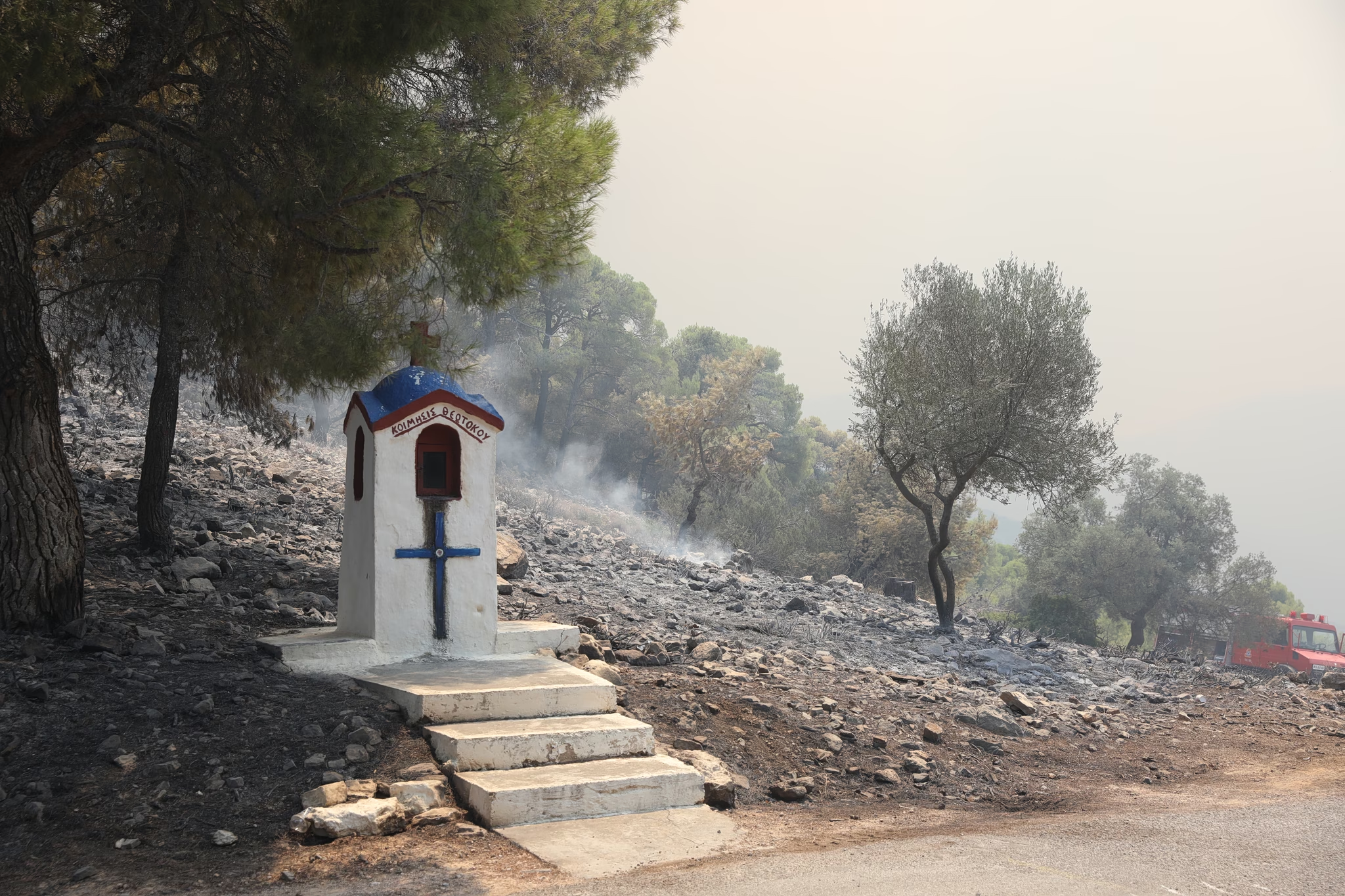
A Category 4 (Very High) wildfire risk has been forecast for Friday in several critical regions of Greece, as indicated by the Fire Risk Prediction Map released by the General Secretariat for Civil Protection, operating under the Ministry of Climate Crisis and Civil Protection (civilprotection.gov.gr).
Regions facing the highest alert level include:
• Attica Region, including the island of Kythira (Kythera)
• Central Greece Region (Regional Unit of Evia)
• Peloponnese Region (Regional Units of Corinth, Argolis, and Laconia)
• North Aegean Region (Regional Units of Chios, Samos, and Ikaria)
Authorities have already been placed on high alert. The General Secretariat has informed all relevant state agencies, regional authorities, and municipalities in the affected areas to ensure enhanced preparedness and a rapid response in case of fire outbreaks.
Citizens are urged to exercise maximum caution and avoid any outdoor activities that could accidentally spark a fire. These include burning dry grass or branches, using equipment that emits sparks such as angle grinders and welding tools, operating outdoor grills, beekeeping smoke activities, and discarding lit cigarettes. It is also emphasized that open field burning is strictly prohibited during the fire season.
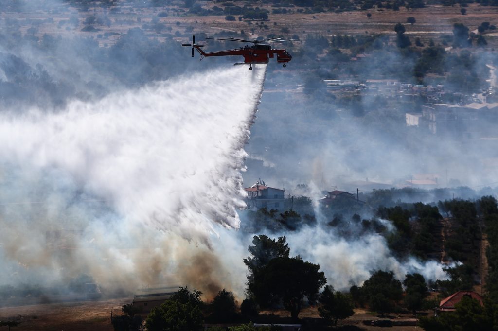
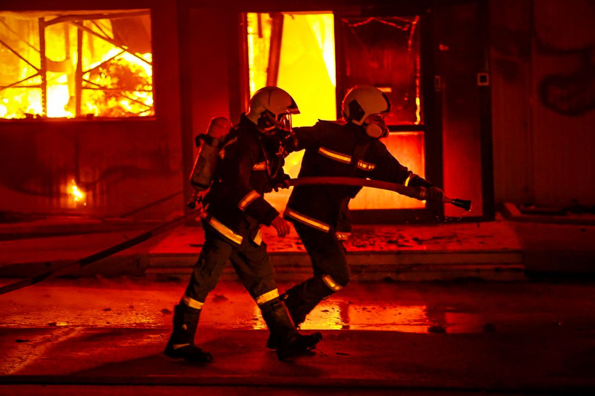
The Greek Fire Service remains at Operational Readiness Level 2, with air and ground patrols being intensified.
Firefighters, police, and military units are already deployed for surveillance and rapid response duties. Fire service personnel in the high-risk zones will remain partially on standby to manage potential emergencies.
Additionally, the Civil Protection Action Plan remains in effect. Among its provisions is the preventive restriction of vehicle circulation and visitor access to national parks, forests, and other vulnerable areas in the regions at risk.