 Μake us preferred on Google
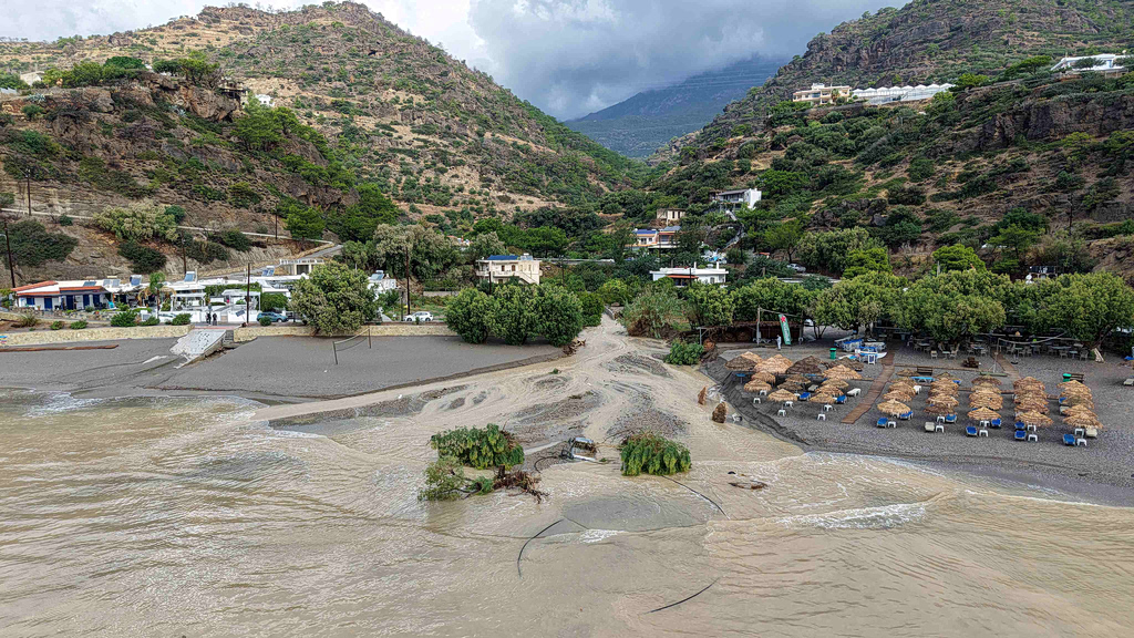
 Greece’s latest bout of severe weather entered its most intense phase on Saturday, with Crete once again bearing the brunt of torrential rain and thunderstorms after days of flooding, landslides and infrastructure damage, while powerful northeasterly winds disrupted coastal travel and battered parts of the island.
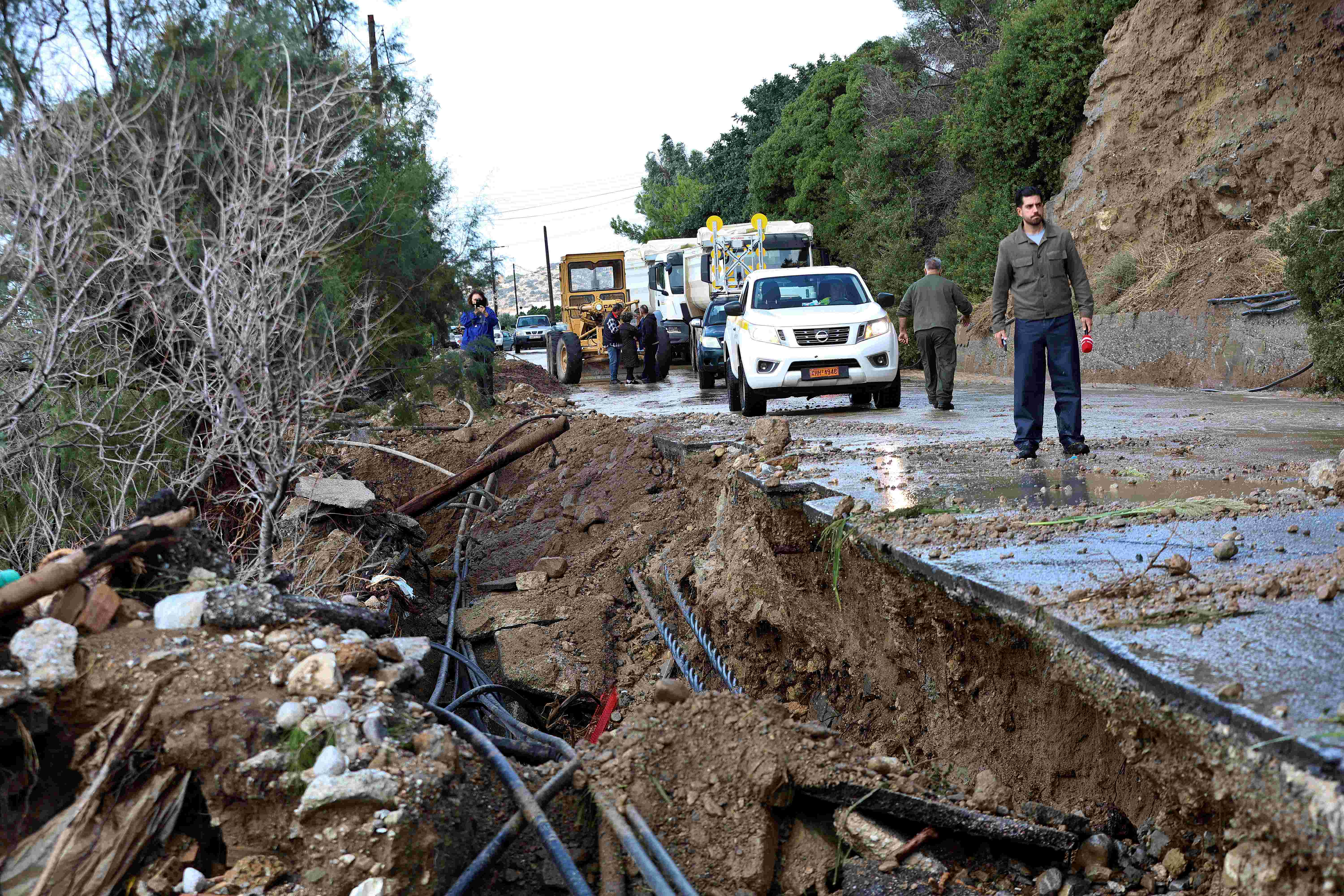
The weather system had already caused extensive problems across Crete earlier in the week, including flooding, damaged roads and landslides, before a second wave of heavy rain and thunderstorms moved across the island from Friday. The municipality of Mylopotamos, one of the areas hardest hit, has been placed under a state of emergency.
By Saturday morning, rainfall totals in northern and mountainous parts of Crete had reached exceptional levels. At Xyloskalo in the Chania regional unit, accumulated rainfall reached 318 millimeters between Friday and Saturday morning, according to the automatic weather station network of the National Observatory of Athens.
That amounts to 318 liters of water falling on every square meter of ground.
The heaviest rain was recorded in the mountainous and northern parts of the island, where intense rain and thunderstorms had continued from Friday through the early hours of Saturday.
More storms expected through Sunday
Members of the government’s risk assessment committee met on Saturday in the presence of Climate Crisis and Civil Protection Minister Evangelos Tournas to assess the evolving situation.
Scientists on the committee warned that strong rain and thunderstorms would continue across Crete through Saturday afternoon before gradually weakening from the evening, although less intense phenomena were expected to persist through Sunday morning.
The Dodecanese was also expected to come under the influence of strong rain and thunderstorms from Saturday afternoon through Sunday midday.
Meanwhile, locally very strong northeasterly winds in the Aegean were forecast to ease slightly from the afternoon.
Crete remains under a red code mobilization status through Sunday, keeping civil protection and emergency services on heightened readiness.
Chania hit by wind and waves
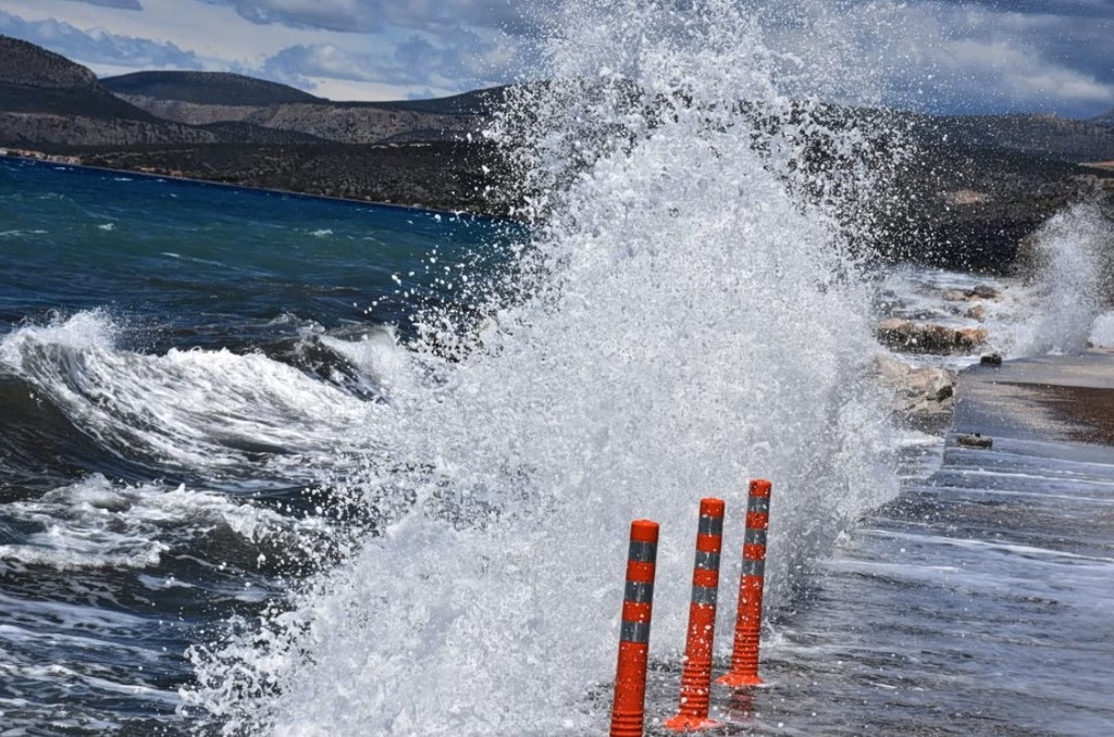
The combination of heavy seas and strong winds caused significant problems along the coastal zone of Chania (Hania).
The Venetian Old Port was particularly affected, with powerful waves hitting waterfront restaurants and tourism businesses. Parts of the beach at Nea Chora also suffered erosion, damaging equipment used to serve visitors and beachgoers.
The latest problems came after several days of severe weather had already strained the island’s infrastructure.
Workers stranded at Samaria Gorge
Heavy rain in the Sfakia area and around the Samaria Gorge also left eight employees of the national park temporarily unable to exit.
The workers were reported to be in a safe location and in constant communication with the authorities. Authorities said they were inside a staffed station with food, medicine and adequate heating, but that the level of the river prevented their departure.
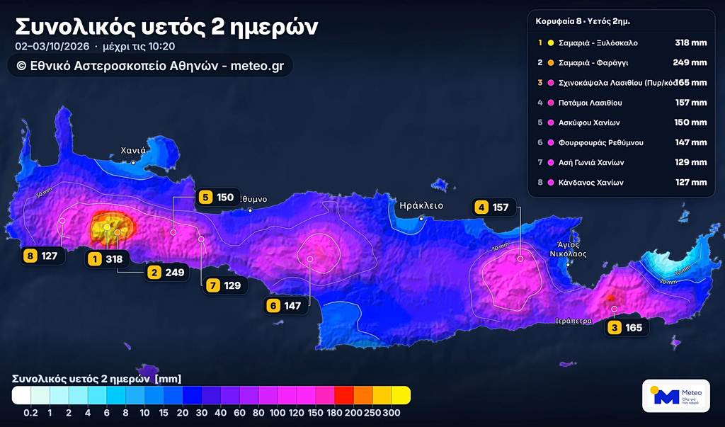
A map shows accumulated rainfall totals and the eight highest rainfall measurements recorded from Friday, Oct. 2, through 10:20 a.m. Saturday, Oct. 3, 2026, across Crete, according to the automatic weather station network of the National Observatory of Athens.
Problems elsewhere in the islands
Crete was not the only island affected. On Friday afternoon, authorities in Paros found a French-flagged vessel taking on water and developing a dangerous list inside the fishing shelter at Paroikia. No one was aboard.
Port officials discovered the vessel during a patrol and determined that water had entered the boat amid the adverse weather conditions. A professional diver and a specialized crane truck were brought in as part of the rescue operation, allowing the vessel to be safely lifted onto land.
The Paros Port Authority subsequently prohibited the vessel from sailing until repairs are completed.

Ferry services gradually resume
Strong winds had also disrupted ferry traffic for a second consecutive day, leaving vessels in ports and forcing operators to cancel or modify services. On Friday, winds in parts of the Aegean reached 9 Beaufort, prompting extensive sailing restrictions from the greater Athens-Piraeus a.
As conditions began to ease on Saturday afternoon, ferry services from Attica were expected to gradually resume.
Departures from Piraeus were expected to restart after 4 p.m., including vessels that had remained docked because of the strong winds. Evening services to Crete were also expected to operate as scheduled.
Fast Ferries announced that its Dionysios Solomos service from Piraeus to Serifos, Sifnos, Kimolos, Folegandros, Sikinos, Ios and Santorini would operate on Saturday, but with a revised departure time of 5:45 p.m., instead of the originally scheduled 2:45 p.m.
Travel conditions remained dependent on the continuing evolution of the weather and the decisions of port authorities.
A difficult end to turbulent week
The latest storm system follows an unusually disruptive period of weather in Crete. Earlier rainfall had already caused flooding in homes and businesses, road damage, landslides and river overflows, while one livestock farmer died during the previous storm episode. Authorities subsequently reinforced the island’s firefighting and rescue capacity with specialized water-rescue teams, boats and pumping equipment.