 Μake us preferred on Google
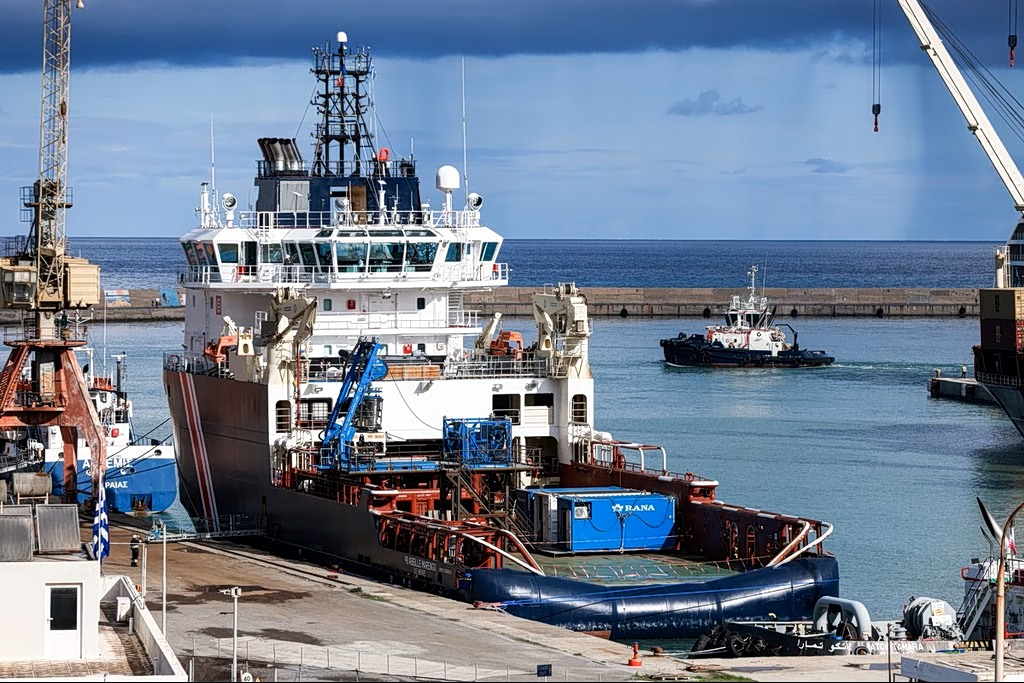
The vessel, which has been docked at the port of Heraklion (Irakleio) for the past 10 days, is scheduled to carry out surveys along the planned route of the undersea cable, with operations initially returning to the area off Kasos, where previous work was suspended in July 2024.
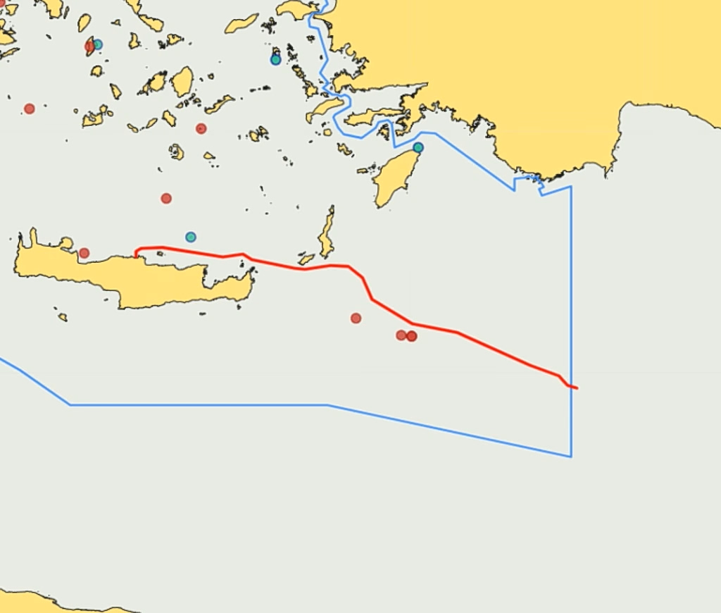
The NAVTEX issued by Greece on Friday, Nov. 6, 2026.
The survey area includes waters outside Greece’s territorial sea but within an area over which Athens claims potential continental shelf rights. Greece maintains that authorization for marine research in areas under its jurisdiction falls exclusively within the competence of the Greek authorities.
The NAVTEX, issued by the Hellenic Navy Hydrographic Service, covers the period from Nov. 6, 2026, to March 6, 2027, and specifies a series of geographical coordinates extending from the southeastern coast of Crete toward the waters east of Rhodes and south of the Dodecanese.
The foreign ministry said on Friday that all required licensing procedures had been completed following an application by French cable manufacturer Nexans, acting on behalf of the project-owning company GSI.
Following a positive recommendation from a relevant inter-ministerial committee, Foreign Minister George Gerapetritis signed the authorization on Friday.
The research vessel subsequently requested the issuance of the required navigational warning, which was issued immediately.
Athens has stressed that any notification to Turkey concerning the vessel’s movements does not constitute a request for permission, recognition of competing maritime claims or acceptance of any third country’s rights in the area.
Turkey’s maritime claims; risk of a NAVTEX dispute
Turkey continues to maintain its claims over maritime zones in the area, invoking the controversial 2019 Turkish-Libyan maritime memorandum and coordinates it has submitted to the United Nations. Greece rejects the memorandum as unlawful and maintains that it cannot affect its sovereign rights or maritime entitlements.
Turkish Foreign Minister Hakan Fidan has reiterated Ankara’s demand for prior coordination and written notification concerning the planned operations. Turkey has sought to portray such communication as necessary for the implementation of the project, while Athens insists that notification cannot be construed as a request for Turkish authorization.
The issue has also acquired a French dimension, given that the French investment group Meridiam has a majority stake in the GSI project, giving Paris a direct commercial interest in its implementation. The French side has been involved in diplomatic contacts with Ankara in an effort to prevent a renewed confrontation over the surveys.
Ankara is expected to respond to the Greek NAVTEX with a counter-NAVTEX, maintaining its objections to the jurisdiction claimed by Greece. Such a move would renew the competing maritime claims in the area, although Athens is prepared to address any Turkish response through diplomatic and operational measures.
The previous round of surveys, conducted by the Italian research vessel Ievoli Relume, was interrupted in July 2024 after Turkish warships appeared in the area off Kasos, prompting a prolonged confrontation between the two countries.
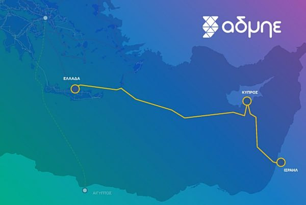
Athens has stressed that the GSI is a European project involving Greece, Cyprus and France, with EU funding, and that any interference would therefore have implications extending beyond bilateral Greek-Turkish relations.
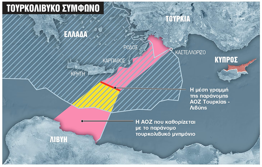
A map shows the approximate delimitation of maritime regions attempted by Turkey and Libya in 2019, with a relevant memorandum between the two states, however, deemed as illegal and baseless by Greece, other regional countries and the EU.
The Greek NAVTEX
The navigational warning issued on Friday by the Hellenic Navy Hydrographic Service specifies the following survey area and operational period:
ZCZC HA15 061413 UTC NOV 26 IRAKLEIO RADIO NAVWARN 1411/26 EAST CRETAN SEA SOUTHEAST CRETAN SEA EAST MEDITERRANEAN SEA RESEARCH OPERATION FOR UNDERWATER CABLE INSTALLATION WILL BE CONDUCTED BY 'ABEILLE MARENGO' FROM 06 NOV 26 UNTIL 06 MAR 27 IN THE LINE BETWEEN THE POINTS: 35 24.98N – 024 56.13E 35 28.18N – 024 56.56E 35 29.86N – 024 59.46E 35 30.28N – 025 14.95E 35 25.04N – 025 57.13E 35 26.62N – 026 10.82E 35 23.13N – 026 17.24E 35 21.44N – 026 31.46E 35 18.51N – 026 47.22E 35 18.15N – 026 54.30E 35 19.95N – 027 11.84E 35 19.34N – 027 24.74E 35 12.93N – 027 34.55E 35 00.96N – 027 41.45E 34 46.87N – 028 09.64E 34 41.74N – 028 40.27E 34 26.01N – 029 24.87E 34 22.57N – 029 32.16E 34 16.97N – 029 51.75E 34 11.28N – 029 57.82E 34 09.68N – 030 04.31E WIDE BERTH REQUESTED 2NM CANCEL THIS MSG ON 062200 UTC MAR 27