 Μake us preferred on Google
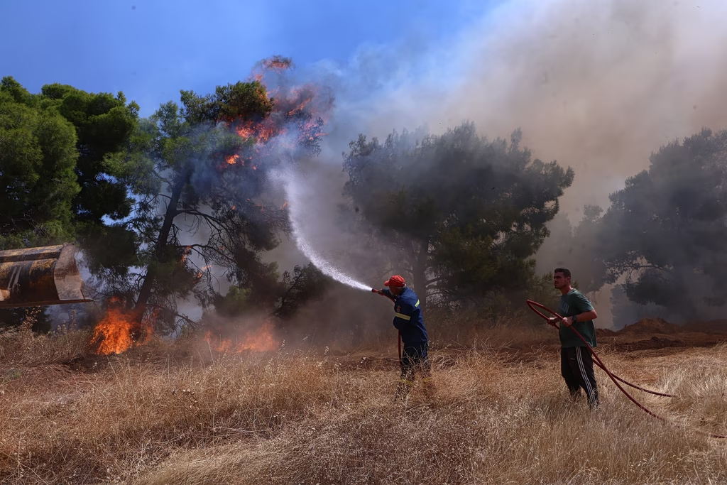
 Newly updated analysis of burned areas from major wildfires between 2018 and 2026 in the mainland part of the Western Attica regional unit reveals striking figures. The data was revised following the major fire that broke out at Porto Germeno on July 31, 2026.
According to the Copernicus Emergency Mapping Service and the European Forest Fire Information System (EFFIS), six major wildfires have burned more than 120,000 acres in Western Attica over the past eight years. The total extent of the affected areas is shown on the accompanying map.
It’s worth noting the Porto Germeno fire is still active, with the burned-area estimate based on data through midday Sunday, August 2, 2026.
The figures will be updated once the final extent of the damage from the Porto Germeno fire is confirmed.
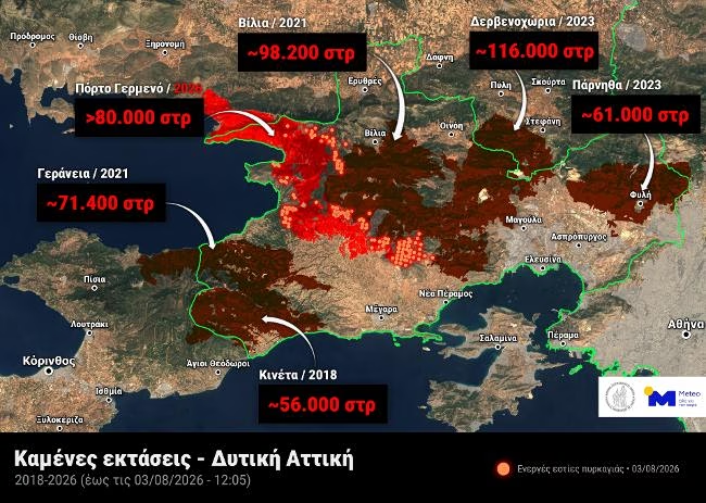
Satelite imagery showing the extent of burned areas across Western Attica in the last 7 years
“The Western Attica Fire Is Generating Its Own Wind Field”
A fire meteorologist with the FLAME team at the National Observatory of Athens’ Meteo unit, discussing why the Western Attica fire remains so destructive despite relatively moderate winds, told in.gr that after covering such an enormous distance, the fire no longer needs very strong winds to be extremely destructive.
He explained that although Monday’s winds are milder, at 4 to 5 on the Beaufort scale, their intensity periodically allows the fire to generate its own convective column and create its own wind field. The result is that the fire keeps burning wherever it still can, in areas it hasn’t yet reached. It flares up again at intervals, consuming whatever lies in its path, now following the terrain and vegetation of the area rather than the wind alone.
He added that August is the toughest month from a fire-weather standpoint, and that his thoughts are with the firefighters on the ground currently having to deal with what amounts to a monster.